Home
![]()
Northside
Trails
![]()
New
Almaden
Trail
![]()
Southeast
Trails
![]()
New
Almaden,
Museum
![]()
Southwest
Trails
![]()
Links
![]()
Bay Area Hiking
![]()
County
Parks![]()
Almaden Quicksilver County Park
Trails to English Camp and the Southwest Side
Mine Hill Rotary Furnace
![]()
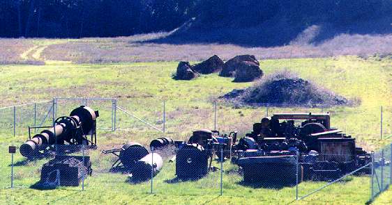
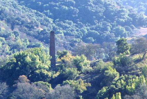
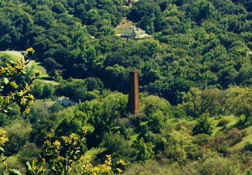
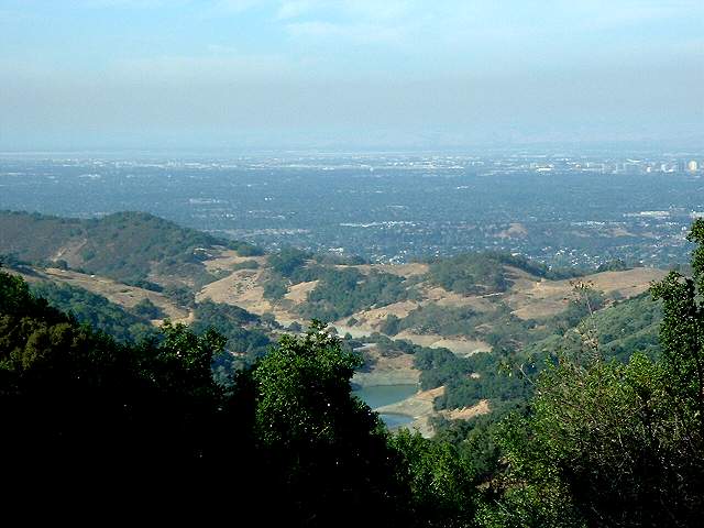
From the Hacienda Entrance to the park in New Almaden, the Mine Hill Trail climbs up the hills into the park. To the west, the open field of the Hacienda Reduction Works site can be seen. There is a fenced-off collection of mining machinery there. The huge furnace yard produced over a million flasks of mercury. Sitting on a hill, surrounded by trees, is one of the park's most prominent landmarks: the Almaden Quicksilver Chimney. The chimney was built in the 1870's. It vented sulfur fumes from the reduction works below it. The chimney is cracked and could fall down in an earthquake, so it is not pubicly-accessible. Plans have been proposed to restore and reinforce it. The Mine Hill Trail climbs up on its ascent of Mine Hill and reaches a trail junction after 0.4 miles. The Hacienda Trail goes off to the right, while the English Camp Trail leads up to the left. (The start of the Mine Hill Trail is described in more detail in the Southeast Trails page.)
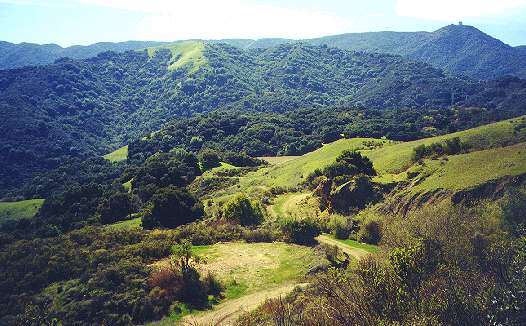
For many years, the section of the park south of Mine Hill was off-limits due to hazardous structures and mercury contamination. In 1999, the county opened up this area, after restoring it and containing the contamination. This area includes the site of English Camp, also called English Town. The steep pedestrian/equestrian English Camp Trail leads up to English Camp. Bicycles can take the Mine Hill Trail to the Castillero Trail. The Yellow Kid Tunnel Trail and the Castillero Trail lead southwest from English Camp, wrapping around the south side of Mine Hill.
Trail List:
- English Camp Trail
- Yellow Kid Trail
- Mine Hill Rotary Furnace
- Castillero Trail
- Wood Road Trail
- Deep Gulch Trail
The English Camp Trail
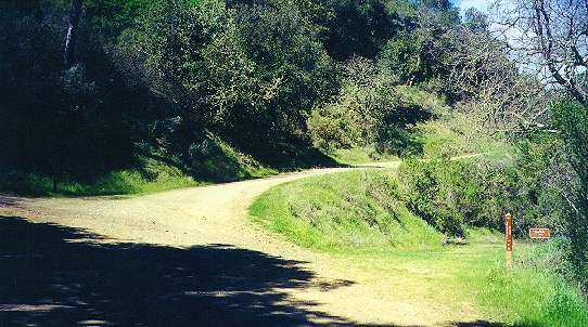
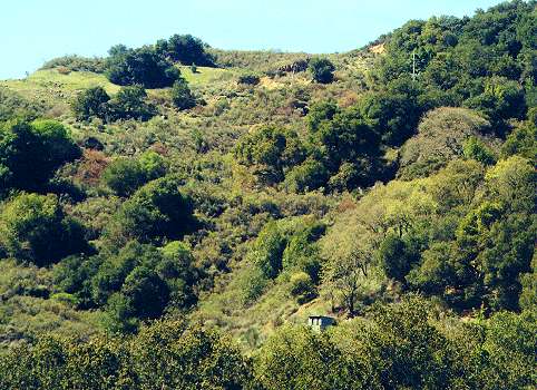
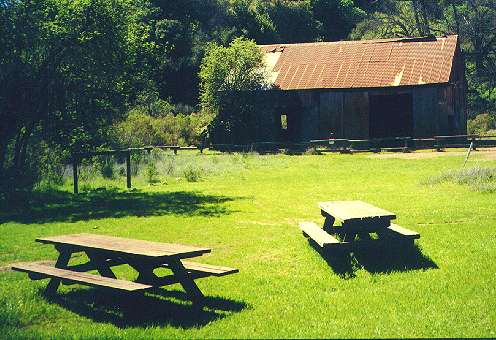
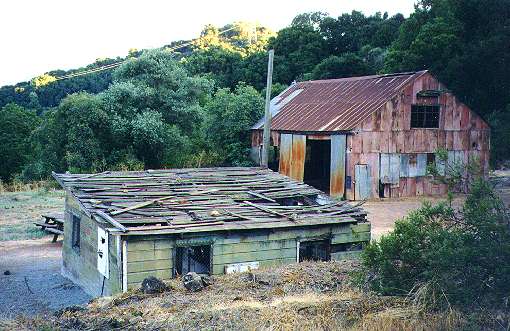
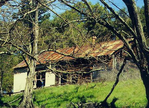
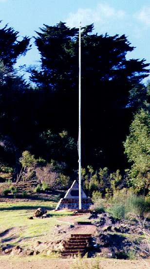
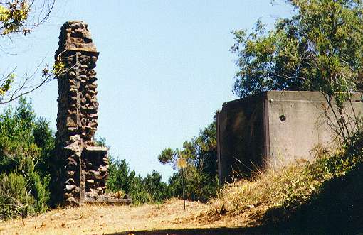
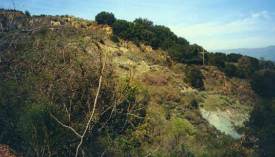
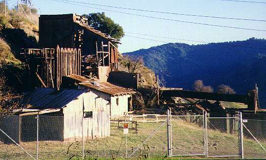
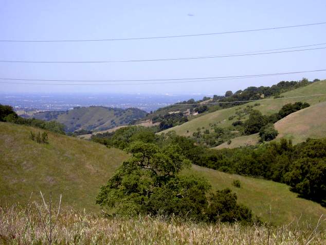
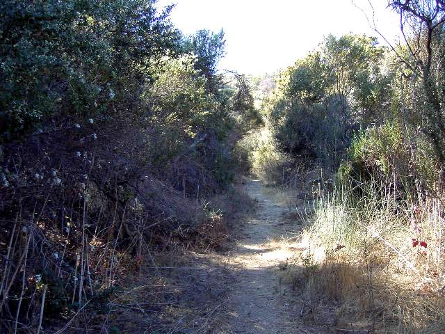
The English Camp Trail runs for 1.27 miles from the Mine Hill Trail to English Camp. It is a wide, gravel path on the southern slope of the same hill that the Mine Hill Trail runs along. Because of its southern exposure, it is a hotter and drier trail than the Mine Hill Trail. Shade is intermittent. It runs next to a wide canyon that narrows to a shady ravine near the top. Remnants of old mining roads and closed-up mine shafts can be seen along the way. The trail provides the best views of the Almaden Quicksilver Chimney. Near the top, the newly-opended Deep Gulch Trail branches off to the west and heads downhill (see below). After a long climb, it finally reaches the site of English Camp. This was originally a settlement established by Cornish miners in the 1860's. It was a town for the miners and their families, numbering about 1,000. The site included a schoolhouse, company store, mining office, Methodist church, community halls, and family cabins. As mining declined in the 1900's, the town was abandoned, and the buildings fell into disrepair. Many were later torn down by the Army Corps of Engineers. The town was later occupied by the Civilian Conservation Corps firefighters in the 1930's. They were housed in barracks that the Army Corps of Engineers had built for a vocational school. The camp was called Camp Mt. Madonna, after its original location near Gilroy. A few ghostly buildings in various stages of decay remain in English Camp, as well as a memorial to the CCC. There are picnic tables in a clearing near an old barn and garage. On nearby Church Hill are an old mining office and the chimney and vault from another mining building.Click on the thumbnails below to see a larger picture:
 |
 |
 |
 |
|
|
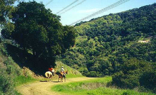
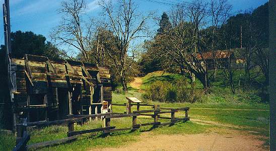
Junction of the English Camp Trail (left), Mine Hill Trail (ahead), and the Hacienda Trail (right) |
|
|
 |
 |
 |
 |
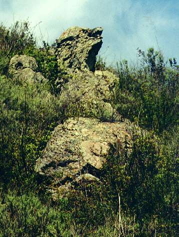
| Almaden Quicksilver Chimney on the hill southwest of the Hacienda entrance above the Hacienda Reduction Works site | Strange rock formations above the English Camp Trail that looks like a screaming face | View of the Almaden Quicksilver Chimney from higher up on the trail | Looking up towards Mine Hill and the Yellow Kid Tunnel, old mining shack on hillside |
 |
 |
 |
 |
|
|
Picnic tables by barn at English Camp |
|
|
 |
 |
 |
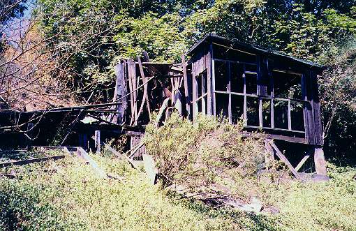 |
| Old mining company office on Church Hill | Flagpole and CCC monument at English Camp | Chimney and concrete vault at English Camp | Remains of home near English Camp |
The Yellow Kid Tunnel Trail to the Castillero Trail
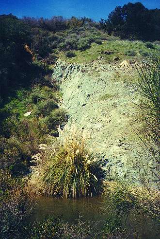
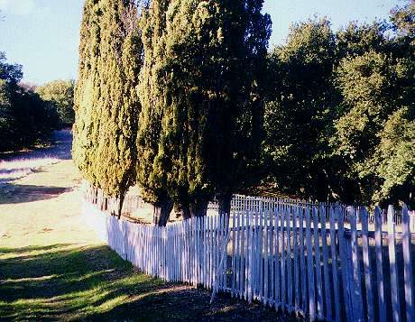
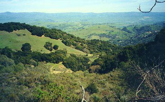
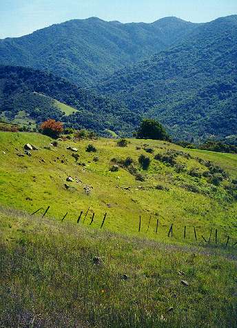
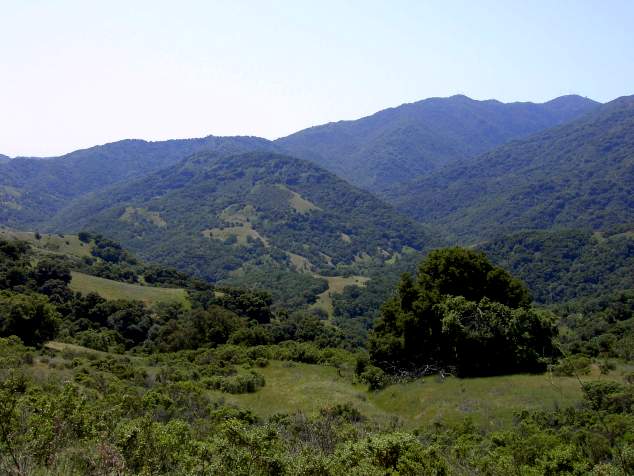
The Yellow Kid Tunnel was named after a popular American comic strip before the turn of the century, featuring an Irish immigrant boy in a yellow shirt. It was the first color comic strip in U.S. history. The tunnel's name was inspired by a yellow vein found in the earth here. The Yellow Kid Tunnel Trail is a narrow footpath that runs parallel to and below the multi-use Castillero Trail. It winds around a hill surrounded by high vegetation, including flowering broom plants. It then climbs up and runs along the side of a steep hillside, with spectacular views of the English Camp Trail and the surrounding hills. The remains of the Yellow Kid Tunnel can be seen below. The tunnel was 200 feet long, 80 feet deep, and 30 to 70 feet wide. Above the trail, nearly hidden behind bushes, is the most historically significant mine tunnel in the park. This is the "Main Tunnel," the site of the first mining activity in New Almaden and the primary entrance to the New Almaden Mine. A settlement called Spanish Camp grew up around the site in the 1850's, made up of Spanish, Mexican, and Chilean miners and their families. The pond below the tunnel opening was used as a swimming hole by the miners' children. The Yellow Kid Tunnel Trail ends at the junction of the Wood Trail and the Hidalgo Cemetery Trail. The Hidalgo Cemetery Trail leads southeast to the Hidalgo Cemetery, the southernmost accessible hillside point in the park. The grave markers are gone, but the cemetery is marked by a white picket fence and Italian cypresses. A wooden grave marker from the cemetery has been preserved in the Almaden Quicksilver Mining Museum. The Wood Trail is a short connector to the Castillero Trail. The Castillero Trail starts at English Camp. It rounds Mine Hill, revealing dramatic views of Jacques Ridge and the Sierra Azuls. The area along the hillside bears the scars of heavy construction. The side of Mine Hill has been sealed up to contain mercury contamination. A system of drainage channels controls runoff. Discarded rusting mining equipment litters the area.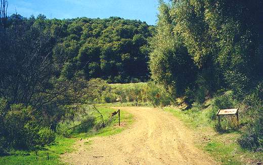 |
 |
 |
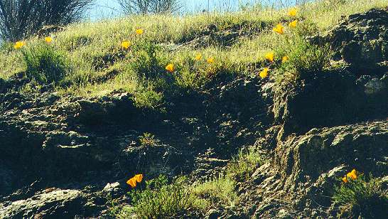 |
| Yellow Kid Tunnel Trail branches off to the left from the Castillero Trail near the English Camp schoolhouse site | English Camp schoolhouse ruins. The school educated 1st through 8th graders from 1864 to 1907 | View down from the Yellow Kid Tunnel Trail | Poppies on a hill above the Yellow Kid Tunnel Trail |
 |
 |
 |
 |
| The site of the Main Tunnel entrance of the New Almaden Mine, with small pond below it | Hidalgo Cemetery | View looking southeast towards the English Camp Trail from the Castillero Trail | Old mine buildings along the Castillero Trail |
 |
 |
 |
 |
| Mine Hill and the Main Tunnel from the Castillero Trail | View of Mt. Loma Prieta south of the Castillero Trail | Mt Umunhum, Jacques Ridge, and hillside drainage system southeast of the Castillero Trail | Old mining equipment near the Castillero Trail |
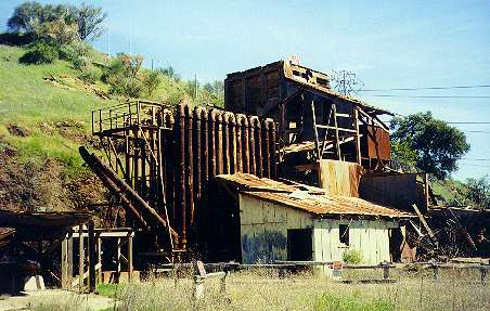
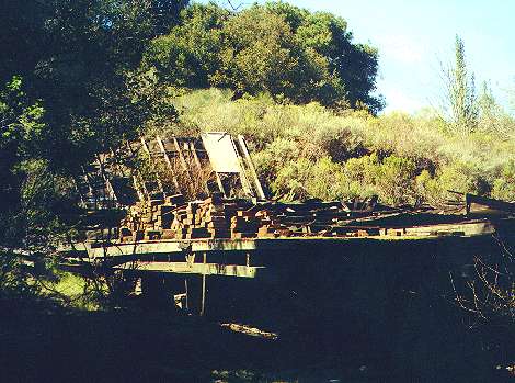
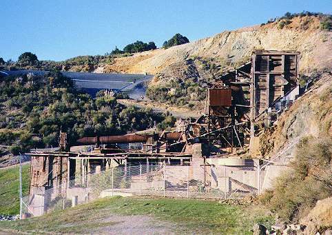
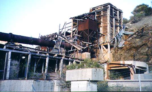
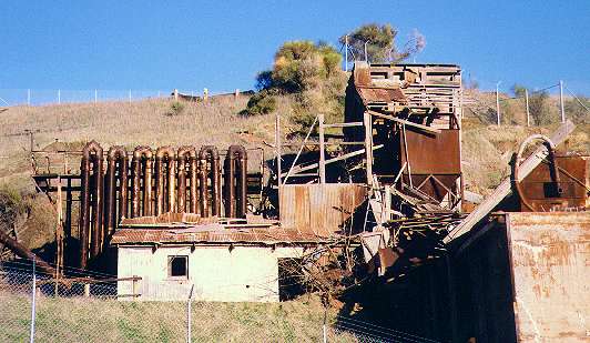
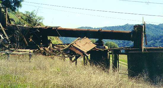
Mine Hill Rotary Furnace
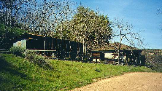
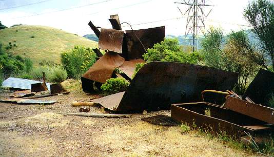
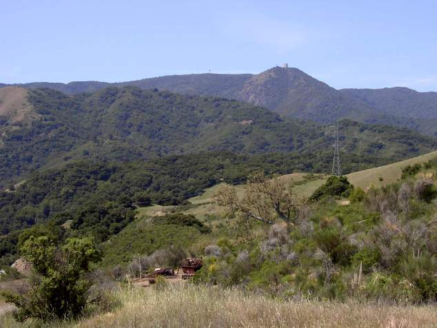
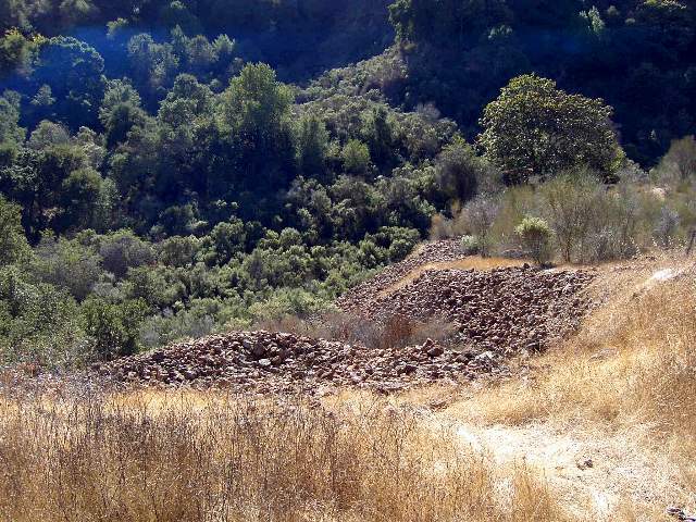
One of the most impressive structures in the park is the huge rotary furnace below the Castillero Trail on the southern slopes of Mine Hill. The facility is hazardous, fenced-off, and off-limits. The rotary furnace was the most modern and most efficient method of mercury extraction used in the area. It was invented in 1939 by engineer H.W. Gould. A model of the Gould rotary furnace can be seen in a display in the Almaden Quicksilver Mining Museum, which explains how it works. Unlike other methods, it heated the mercury ore from all sides, extracting more of the metal. Mercury ore was crushed and fed into a huge rotating pipe. The pipe was heated to 1,700 degrees. As the pipe rotated, the ore was tumbled and turned, exposing all sides of the rocks to heat. The heat produced mercury and sulfur vapors. The sulfur gas was vented into the air. The mercury vapor was condensed in a series of towers. The liquid mercury collected in troughs at the bottom. The 50-ton furnace here replaced a larger 100-ton furnace that was installed in 1940. It processed about 35 tons of ore at a time. It remained operating until 1976, when the area became a county park.
 |
 |
 |
 |
|
|
|
|
|
 |
 |
 |
 |
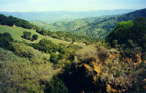
| Left side close-up of rotary pipe | View from hill above rotary furnace, looking towards Jacques Ridge | View of rotary furnace site from Castillero Trail | Jacques Ridge and Mt. Umunhum from Castillero Trail east of rotary furnace (road below is the new Wood Road Trail - see below) |
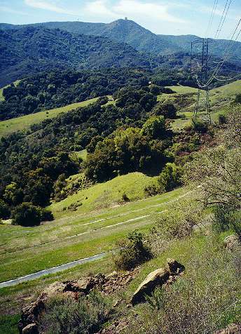
The Castillero Trail to the Mine Hill Trail
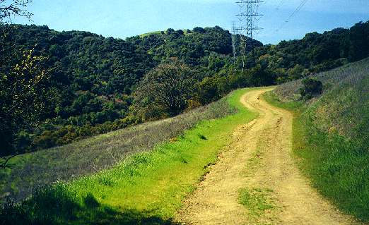
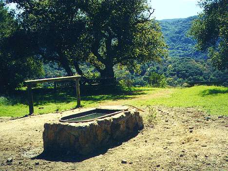
After passing the rotary furnace (see above), the Castillero Trail joins the Mine Hill Trail at Bull Run. Bull Run is at the highest portion of the Mine Hill Trail, where the trail levels off after a long climb from the Hacienda Entrance, then follows along the ridgetop to the northeast. This is covered in the Northside Trails page. There is a horse trough and picnic table there, with views of the Sierra Azuls and the Guadalupe Creek watershed. This section of the Mine Hill Trail is open to bicycles. The Mine Hill Trail and connecting trails to the south are covered in the Southeast Trails page. |
 |
 |
 |
| View of Jacques Ridge and the Sierra Azuls from the Castillero Trail | Horse trough at Bull Run | The Mine Hill Trail leading down from Bull Run back towards the Hacienda entrance | Shady section of the Mine Hill Trail southeast of Bull Run |
See here for pictures from the Almaden
Quicksilver County Park Van Tour 11/17/01, including visits to the
Mining Museum, English Camp Trail, part of the Deep Gulch Trail,
English
Camp, the Mine Hill Rotary Furnace, and the San Crisotobal Mine Tunnel.
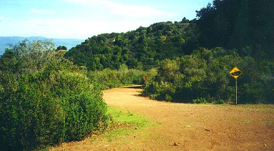
The Wood Road Trail
A new trail entrance has been constructed on Hicks Road on the west boundary of the park, opposite the entrance to the Woods Trail and Mt. Umunhum Road in the Sierra Azul Open Space Preserve. This new trail has a large staging area, large enough to accommodate horse trailers. The trail follows the old Wood Road route and is called the Wood Road Trail. It connects to the Castillero Trail at the Rotary Furnace (see above). It is a short (1.3 miles), but critical part of the Bay Area Ridge Trail, connecting Almaden Quicksilver to the Mid-Peninsula Open Space Preserve trails in the Sierra Azuls. The trail accommodates bicycles, pedestrians, and equestrians. It provides the easiest and shortest access to the heart of the park at Mine Hill. It also provides the only access point on the west side of the park, which adjoins the Sierra Azul Open Space Preserve.Pictures of the Woods Trail, Bay Area Ridge Trail, Sierra Azul Open Space Preserve
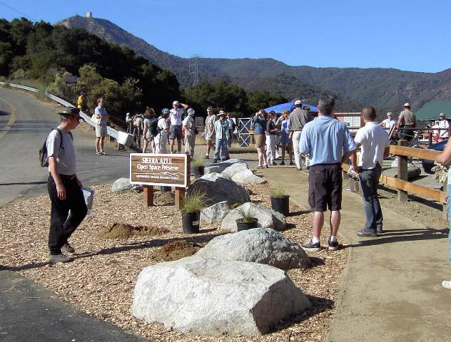
The new Jacques Ridge Staging area has been built by Mid-Pen
on the
west side of Hicks Road at the Mt. Umunhum Road intersection and the
Woods
Trail entrance, marking the newest segment of the Bay Area Ridge Trail.
This segment was dedicated on Oct. 25, 2003, and extended the Bay Area
Ridge Trail by 11.8 miles, providing a Ridge Trail connection between
Almaden
Quicksilver and the Sierra Azul trails that lead over the mountains to
Lexington Reservoir. The completion of the Woods Trail segment was made
possible by acquisition of 905-acre Jacques Ridge by Mid-Pen and Santa
Clara County in 1995. The staging area has a restroom, interpretive
signs,
and room for 14 cars.
 |
 |
 |
 |
|
|
|
|
|
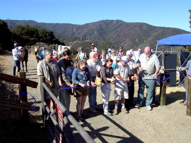
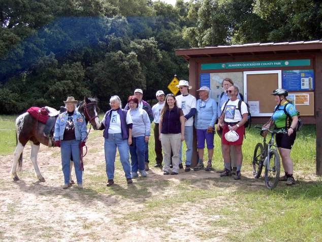
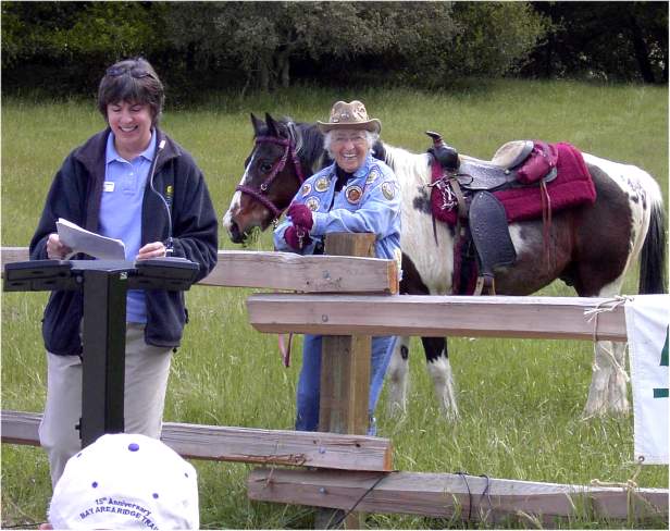
Wood Road Trail Dedication Ceremony in Almaden Quicksilver, April 17, 2004
The Wood Road Trail in Almaden Quicksilver was dedicated on April 17, 2004, along with the entire Bay Area Ridge Trail route through Almaden Quicksilver County Park, after trail construction was completed on the Virl Norton Trail. The Ridge Trail route follows the Wood Road Trail, Castillero Trail, Mine Hill Trail, Hacienda Trail, and the Virl Norton Trail. From there, the existing Ridge Trail route follows the Los Alamitos Creek Trail, Calero Creek Trail, the trails in Santa Teresa County Park, then the Coyote Creek Park chain.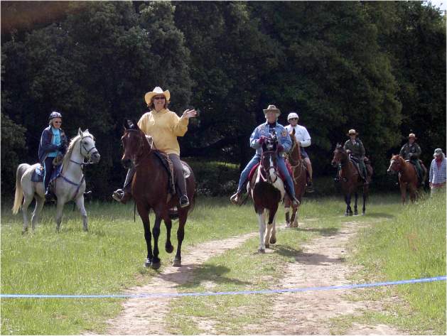 |
 |
 |
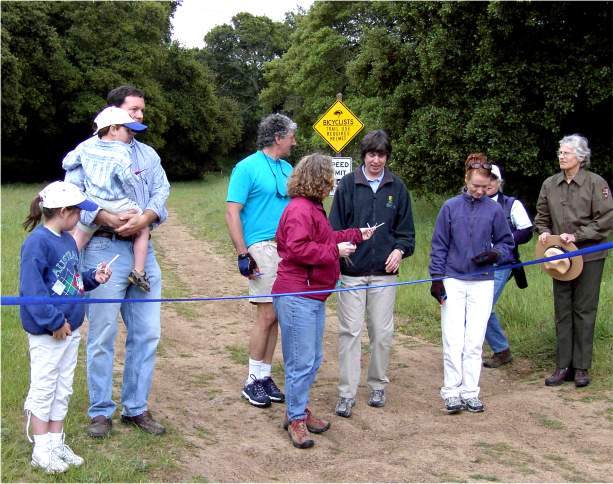 |
| Equestrians coming to the dedication | Parks and open space officials and volunteers by the trail sign | Lisa Killough, County Parks Director, Kitty Monahan, NAQCPA President | Ribbon cutting opening the trail |
Wood Road Trail (Pictures taken April 24, 2004)
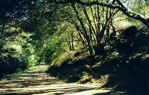
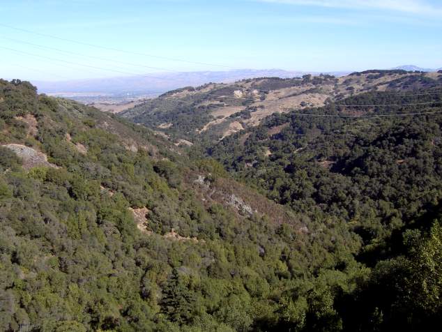
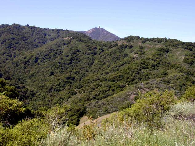
Wood Road is actually an old road that was used to haul wood from the forested slopes of the Sierra Azuls to the mines of New Almaden. Mid-Pen's Woods Trail is a dirt road that starts at the junction of the Limekiln and Kennedy Trails high on the ridge in Sierra Azul Open Space Preserve. It skirts around the 2,999-foot peak of El Sombroso. It drops down steeply and crosses Guadalupe Creek, then gradually rises to the trailhead at Hicks Road. At Hicks Road is a stop sign and crosswalk, providing safe crossing to Almaden Quicksilver.
In Almaden Quicksilver, the Wood Road Trail continues to
follow the
old road. It starts at around the1400-foot level. It runs It runs
through
cool forests and lush meadows along the northwest portion of Jacques
Ridge.
These hills are the source of Los Capitancillos Creek, which flows into
Guadalupe Reservoir and Jacques Gulch, which flows into Almaden
Reservoir.
The trail emerges from forests and drops into a saddle, providing views
of the urban South Bay to the north. The trail gradually
ascends
through dry, open hillsides to the Castillero Trail and the Mine Hill
Rotary
Furnace (see above) at around 1600 feet. Along the way, the trail
provides
spectacular views of the Sierra Azuls and the Almaden Valley, with
glimpses
of Almaden Reservoir.
 |
 |
 |
 |
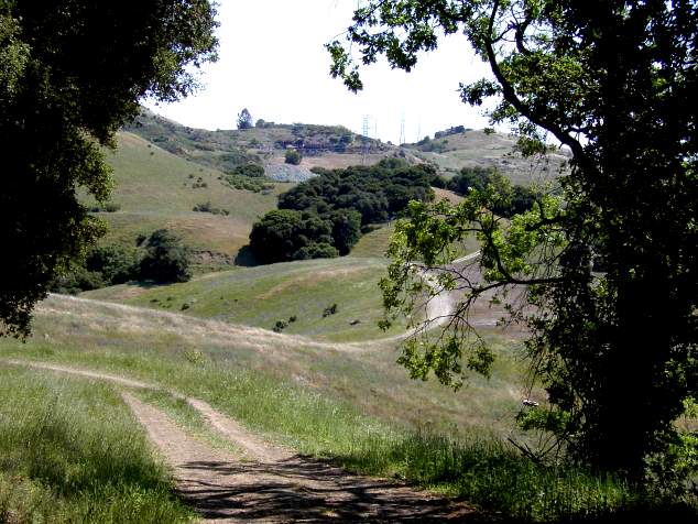
| Trail starts in an oak forest on Jacques Ridge | Mt. Umunhum is visible over a ridge in Sierra Azul OSP, seen west of the trail | Emerging from a forest, the trail drops down from Jacques Ridge, with the Mine Hill furnace visible in the distance | The City of San Jose visible in distance north of trail beyond headwaters of Los Capitancillos Creek |
 |
 |
 |
 |
| Almaden Reservoir and hills outside the park are visible to the south of the trail | Mt. Loma Prieta and the Sierra Azul Range is visible to the southwest of the trail | Along the trail is this large monolith, backed by rocky cliffs | Looking back towards Mt. Umuhum from end of the trail on Mine Hill |
The Deep Gulch Trail
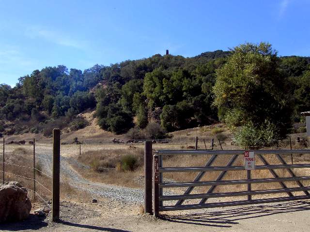
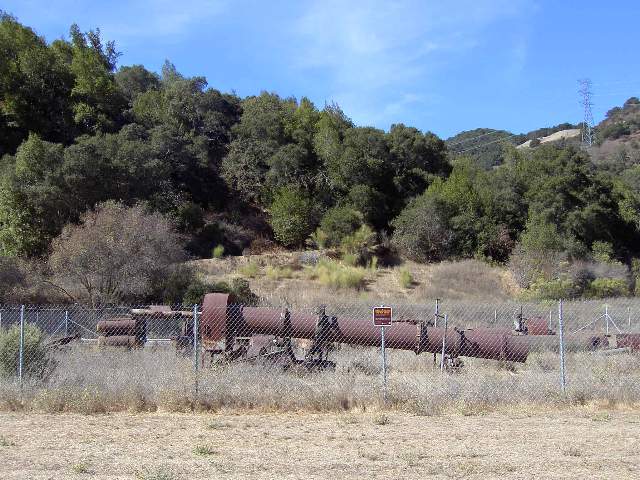
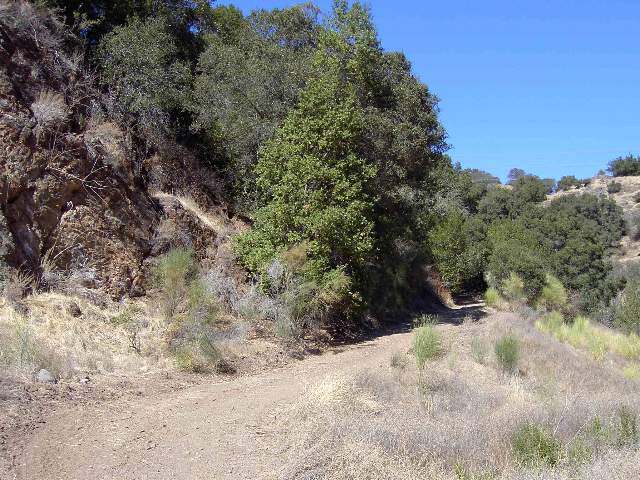
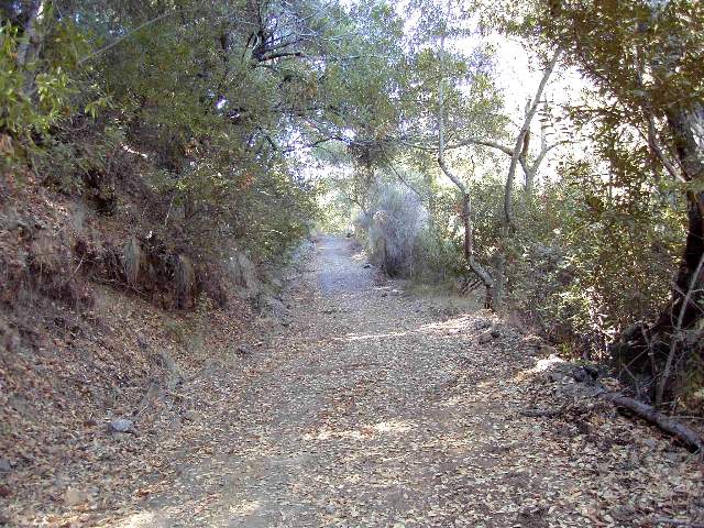
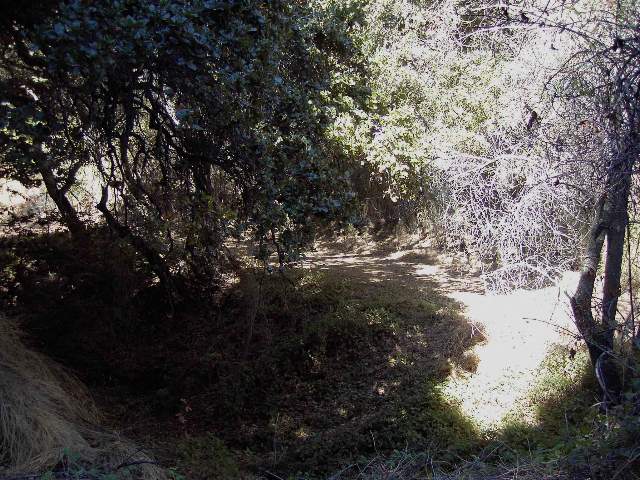
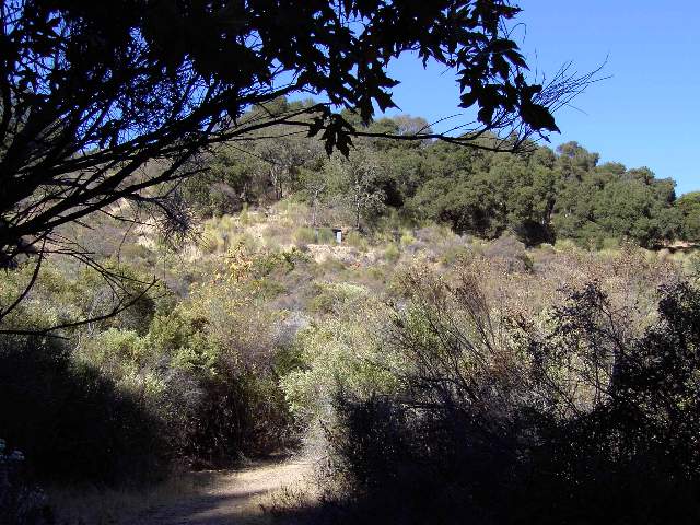
The Deep Gulch Trail follows the route of an old mining road. It runs roughly parallel to the English Camp Trail (see above), on the west side of a deep gulch. It was closed until October 2003, when drainage improvements were completed. The trail begins at the Hacienda staging area. At the parking lot, go west through the Hacienda Reduction Works equipment yard. You can get a closeup view of the old mining equipment behind the fence. The trail begins in the hillside below the Quicksilver Chimney. It runs along the eastside of the hill through dense oak forests as a wide dirt road. This is a shady trail in the afternoon, a cool alternative to the sunny English Camp Trail. The dense foliage provides shade, but it obscures the views. The trail is nearly straight and ascends steadily uphill. Near the start, a well-worn volunteer trail leads uphiill to the left. This is not an official park trail, and it leads to a hazardous area, so I can't recommend it. The Deep Gulch trail begins to rise higher and higher along steep hillsides above the creekbed below. Gradually, the trail and the creekbed run closer together. At one point, the English Camp Trail begins to run closer to the trail, until it is just on the other side of the creek. For a short distance, the trail turns into a single-track, then widens out again. It then emerges from the oak forest and becomes a narrow corridor bordered by tall stands of coyote brush. Soon, the slopes of Mine Hill, with its own mine buildings, can be seen ahead above the trail. The trail then turns to the right and passes by a large pile of mine tailings on the right. This is a clear area, with views of the gulch below. It then turns and joins the English Camp Trail a short distance below English Camp.
 |
 |
 |
 |
|
|
|
|
|
 |
 |
 |
 |
|
|
|
|
|
Created 3/6/2001, updated 3/23/2006 by Ronald Horii