Home
![]()
Northside
Trails
![]()
New
Almaden
Trail
![]()
Southeast
Trails
![]()
New
Almaden,
Museum
![]()
Southwest
Trails
![]()
Links
![]()
Bay Area Hiking
![]()
County
Parks![]()
Almaden Quicksilver County Park
Park Trails - Northside
Senador Mine Herreschoff Furnace Remains
![]()
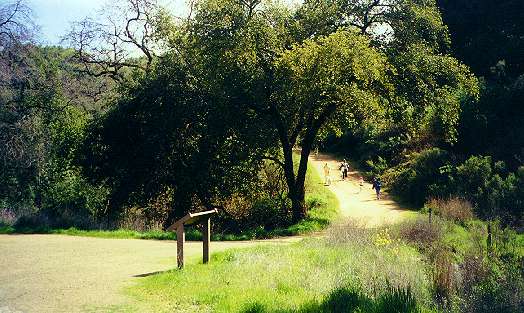
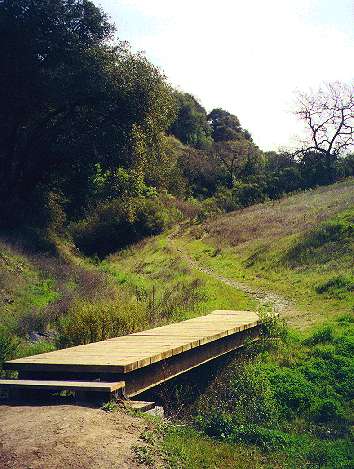
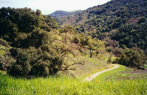
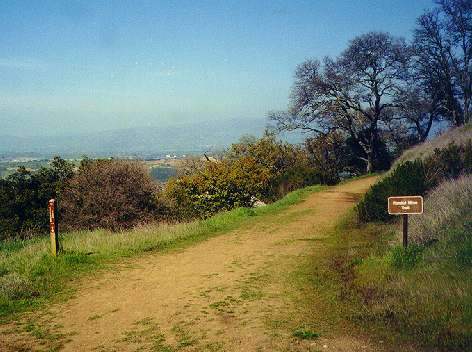
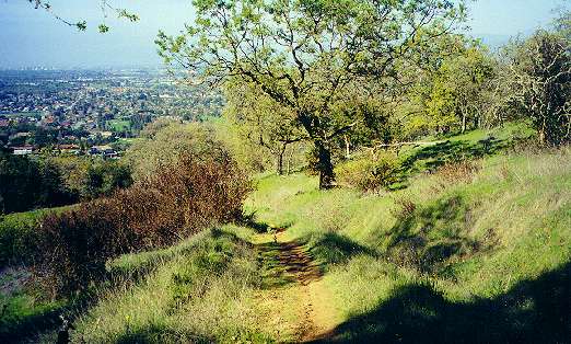
These are pictures along the park's northside trails. They run through some of the most scenic sections of the park. The north entrance is in the middle of a suburb in the Almaden Valley, but it is a neighborhood entrance with no parking lot and is not a staging area. Park visitors are requested either to not park near the entrance or to use the other park staging areas that have parking lots: Mockingbird Lane, the Hacienda, and Hicks Road. Heavy rains may result in trail closures. Bicycles are not allowed in this area. A short paved road passes between the site of a former private dairy on the right and a hill and meadow on the left. The road crosses over a concrete bridge built in 1924 to ford a small creek. The road runs next to the creek and leads to a gate at the junction of the Senador Mine Trail and the beginning of the Mine Hill Trail. Trail maps are available at this junction. The Mine Hill Trail leads up to the left.
Click on the thumbnails below to see a bigger picture:
 |
| Mine Hill Trail junction leading uphill |
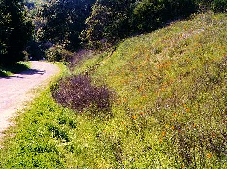
The Senador Mine Trail leads southwest down a narrow valley,
passing
the start of the New Almaden Trail. The hills on the right are covered
with wildflowers, particular poppies, in the spring. The New Almaden
Trail
branches off to the left. It crosses over a bridge and runs as a
footpath
through a narrow ravine, then rises up to join the Mine Trail. The New
Almaden Trail is covered in more detail on the New
Almaden Trail page.
 |
 |
 |
| Poppies along the Senador Mine Trail | Start of the New Almaden Trail from the Senador Mine Trail | Bridge on the New Almaden Trail, leading up to the Mine Trail |
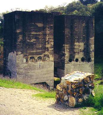
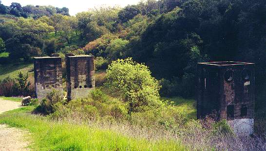
The Senador Mine Trail continues west to the Senador Mines
site. The
site is marked by 3 huge concrete structures, some 2-stories
tall,
that are the remains of the mine's 40-ton Herreschoff Furnace, built in
1915. An historical marker describes the site. The Senador (Senator in
English) Mine opened in 1863 and was worked until 1926. The reduction
plant
was built in 1915. Its Herreschoff multi-hearth furnace and electric
dust
precipitator were the first ever used in the quicksilver industry. The
mine produced some 20,000 flasks of mercury. A picture in the mining
museum shows what the mine site looked like in its heyday. Now, the
area is covered with grasses and chaparral, with huge piles of mine
tailings
on the north side. There's a picnic table and horse trough here. The
Senador
Mine Trail, which up until this point has been relatively level, begins
a long, steady climb up the hill. As it peaks out, it swings around to
the south, providing a view of the mine site below and parts of the
Almaden
Valley and Santa Teresa Hills. The trail ends at the junction with the
Guadalupe Trail at a pass in the hills.
 |
 |
 |
 |
| Remains of the Herreschoff quicksilver reduction furnace | Beginning of the Senador Mine Trail uphill climb | Senador Mine Trail ascending | View from the top of the Senador Mine Trail, looking at Herreschoff Furnace precipitators |
The Guadalupe Trail, which starts at a junction with the Mine
Hill Trail
and the New Almaden Trail, heads west and drops down into the valley of
Guadalupe Creek. Guadalupe Creek flows northwest through the
shady
valley at the foot of the towering Sierra Azul range to the west.
3,486-foot
Mount Umunhum (from the Ohlone word for "hummingbird"), topped by a
decommissioned
Air Force radar station, overlooks the valley. The headwaters of
Guadalupe Creek begin on the slopes of Mt. Umunhum. A large portion of
the Sierra
Azuls, some 14,000 total acres, belongs to the Mid-Peninsula
Regional
Open Space District. It makes up the largest preserve in the district.
The Guadalupe Trail parallels the creek, running through shady oak
forests.
At one point, a short path leads down to the banks of the creek.
 |
 |
 |
 |
| Guadalupe Trail high point looking east | Guadalupe Trail looking west towards the Sierra Azuls | Guadalupe Trail leading to Guadalupe Creek | Meadows along the Guadalupe Trail near Guadalupe Creek |
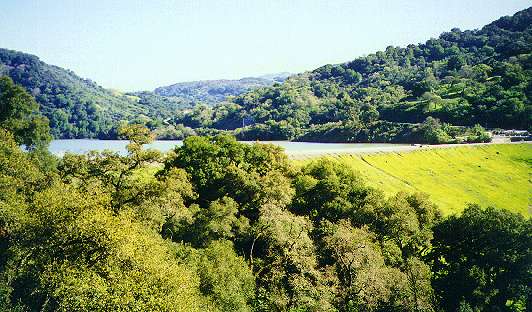
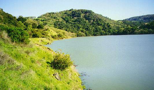
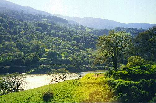
Guadalupe Creek is dammed up to form Guadalupe Reservoir. The
trail
leads up to the dam and rises above the reservoir to join the
Mine
Hill Trail. The east shoreline and the dam are accessible from the
trail.
Swimming is not allowed in the reservoir, but fishing is permitted for
licensed fishermen. However, the fish in this reservoir, as well as in
all bodies of water in the park's watershed, are unsafe to eat due to
contamination
from mercury runoff. It is one of the more unfortunate legacies of the
mercury mining era.
 |
 |
 |
| Guadalupe Reservoir Dam | Lower Guadalupe Reservoir near the dam | Middle to Upper Guadalupe Reservoir |
The Guadalupe Trail ends at the junction with the Mine Hill
Trail. The
6.4-mile long Mine Hill Trail is the highest and second longest trail
in
the park. It runs nearly the entire length of the park, reaching the
park's
high point at 1,700 foot Mine Hill, then descends to the park's
Hacienda
Entrance at Almaden Road, which is covered in the southwest
trails page.
 |
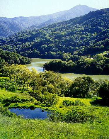 |
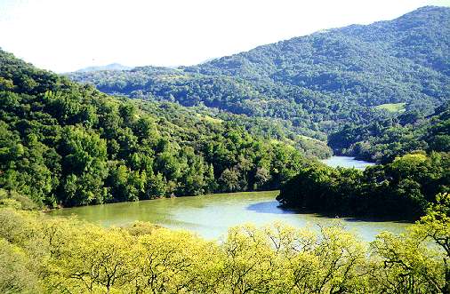
| View from the Mine Hill Trail of the Guadalupe Trail rounding a hill | Looking down at Upper Guadalupe Reservoir from the Mine Hill Trail, Mt. Umunhum in background |
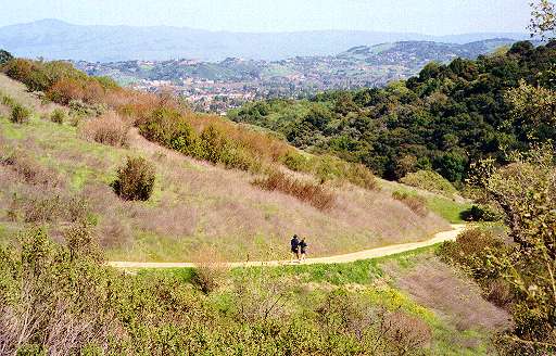
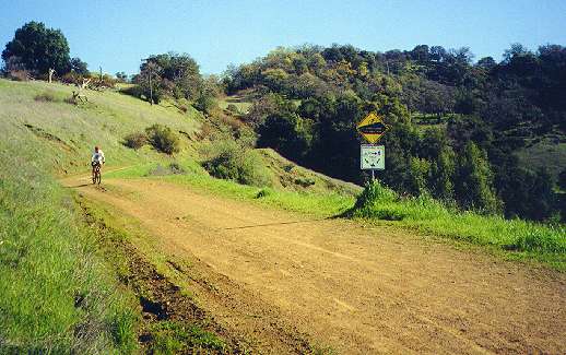
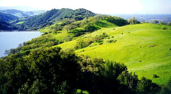
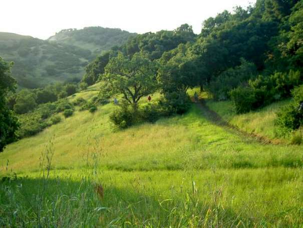
From the junction of the Guadalupe Trail south, the Mine Hill
Trail
passes the beginning of the Randol Hill trail, which branches off to
the
east. The Randol Trail is covered more in the southeast
trail page. The Mine Hill Trail begins to climb steadily to the
south,
with spectacular views of the reservoir and the South Bay. Bicycles are
allowed from here south on this section of the Mine Hill Trail, as well
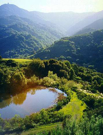
as all of the Randol Trail. A side trail, the Providencia Trail, loops
off the Mine Hill Trail to the west and overlooks a tiny pond,
Providencia
Pond, located on a hillside above the upper reaches of Guadalupe
Reservoir.
The Providencia Trail climbs back up steeply to join the Mine Hill
Trail. From here, the Mine Hill Trail can be taken to the south to the
Hacienda
Entrance, or back to the north to return to the Guadalupe Trail
junction.
 |
 |
 |
 |
|
|
|
View of Guadalupe Reservoir from the upper Mine Hill Trail | View of Providencia Pond from the Providencia Trail, Mt. Umunhum in background |
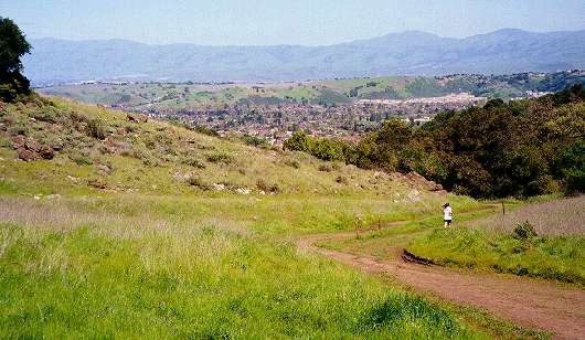
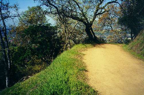
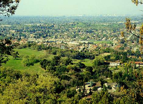
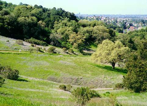
Heading back north on the Mine Hill Trail, from the southern
junction
with the Guadalupe Trail, the Mine Hill Trail runs northwest along the
shady eastern slopes of the hills. (Bicycles are not allowed north of
the
Randol Trail junction.) The Almaden Valley and large portions of the
South
Bay can be seen from gaps in the trees. At 0.4 miles north of the
Guadalupe
Trail junction, the short Cinnabar Trail footpath branches off to the
right
to provide a connector path to the New Almaden Trail.
 |
 |
 |
| The Mine Hill Trail running along the east side of the hills | View of the Almaden Valley and downtown San Jose from the Mine Hill Trail | The Cinnabar Trail dropping down to the New Almaden Trail |
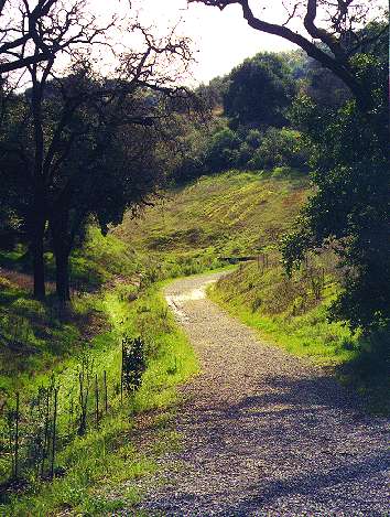
The Mine Hill Trail continues north to meet the northern end
of the
Guadalupe Trail and the New Almaden Trail crossing. The New Almaden
Trail,
which has been approaching along the hillsides from the south, crosses
the Mine Hill Trail and drops down through a narrow valley to its end
at
the Senador Mine Trail. The Guadalupe Trail heads uphill to the west to
join the Senador Mine Trail. The Mine Hill Trail turns to the east,
descends
gradually through a pass, then drops down along the western edge of a
broad
sunny valley where deer can often be seen grazing. It then runs though
a narrow shady ravine to meet the Senador Mine Trail.
 |
 |
| New Almaden Trail descending north of the Mine Hill Trail and Guadalupe Trail junction | Mine Hill Trail descending near the McAbee Road entrance |
A nice, scenic and popular 2-mile walk is to take the Senador Mine Trail to the Guadalupe Trail east, then take the Mine Hill Trail back. This loop takes less than an hour.
Created 3/5/2001, updated 7/2/2009 by Ronald Horii