Home
![]()
Northside
Trails
![]()
New
Almaden
Trail
![]()
Southeast
Trails
![]()
New
Almaden,
Museum
![]()
Southwest
Trails
![]()
Links
![]()
Bay Area Hiking
![]()
County
Parks![]()
Almaden Quicksilver County Park
Southeast-side Trails and Mining Structures
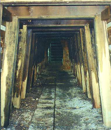
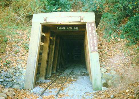
San Cristobal Mine Entrance
![]()
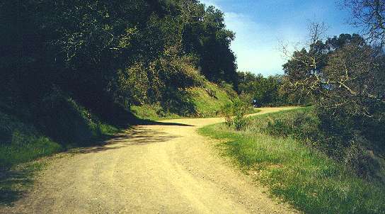
The southeast side of Almaden Quicksilver Park has a wide
variety of
terrain and a number of remnants of the park's mining history. The main
trails here are the Randol Trail and Mine Hill Trails. The Mine Hill
Trail
is like the park's main highway. It starts at the Hacienda entrance in
New Almaden and runs almost the entire length of the park along its
main
spine for 6.5 miles to the park's northern entrance at McAbee Road. The
Mine Hill Trail is the widest, highest, and straightest in the
park,
actually one of the old mining roads. It is one of several trails that
are open to bicycles. It is heavily used by bicycles, equestrians, and
walkers. From the Hacienda Entrance, it climbs in a long, gradual
relentless
climb to its high point at Bull Run, just below the peak of 1740-foot
Mine
Hill. This latter portion can be seen on the Southwest
Trails page. From Bull Run, the Mine Hill Trail runs along the
shadeless
crest of the ridge, then drops down through oak forests past the
Providencia
Trail and Randol Trail. The northern part of the Mine Hill Trail is
described
more in the Northside Trails page.
 |
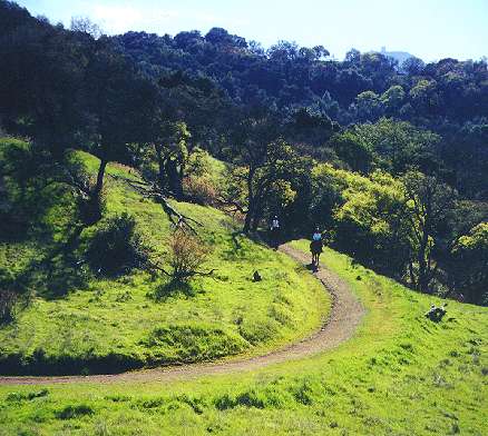
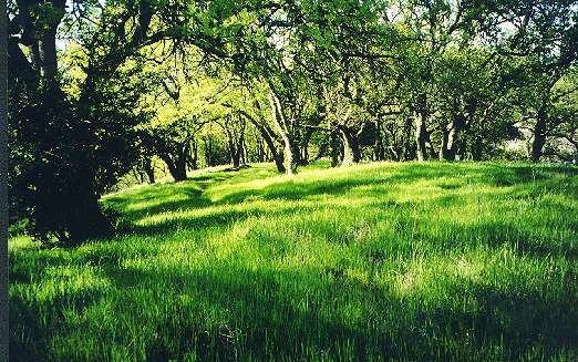
| Mine Hill Trail leading up to Bull Run above the Hacienda and English Camp Trail junction |
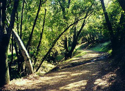
The Randol Trail is one of the longer trails in the park. It
runs along
the middle of the eastern slopes of the park's ridge for 4.7 miles,
in-between
the Mine Hill Trail and the New Almaden Trail. It is shadier and
flatter
than the Mine Hill Trail. It is wider and sunnier than the New Almaden
Trail. It starts in the south at the junction of the Mine Hill Trail
and
the Capehorn Pass Trail. It runs relatively level, while the Mine Hill
Trail continues to climb. The Randol Trail follows the contours of the
hillsides, winding in and out of narrow canyons, but not as much as the
New Almaden Trail. The trail is open to bicycles and is much easier
than
the Mine Hill Trail, but it does have some short ups and downs. It
passes
by the Day Tunnel and the Buena Vista Shaft Site, which are shown
below.
The Randol Trail eventually ends at the Mine Hill Trail just south of
the
Guadalupe Trail junction. The northern junction of the Randol Trail
with
the Mine Hill Trail is described more in the Northside
Trails page.
 |
 |
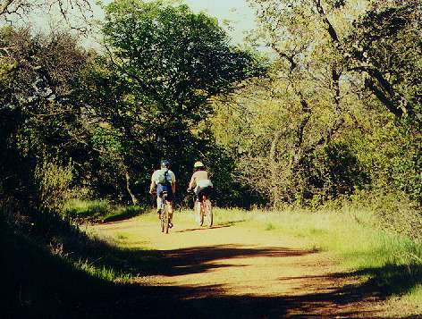 |
| Bend in the Randol Trail | Shady portion of the Randol Trail | Bicycles on the Randol Trail |
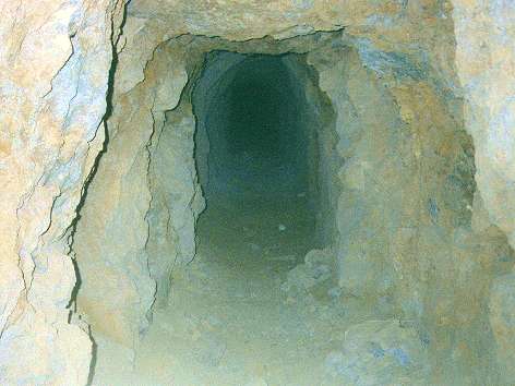
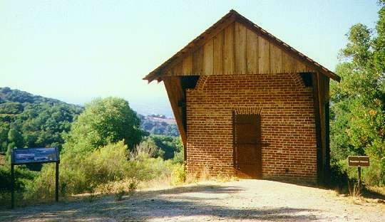
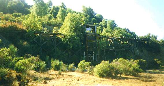
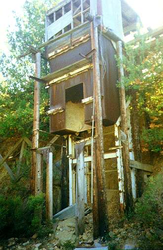
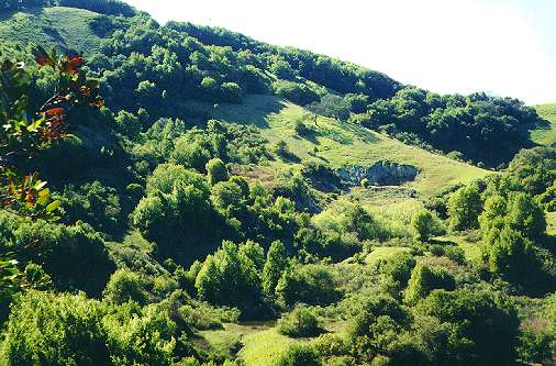
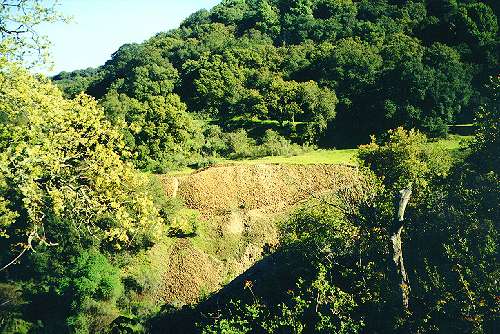
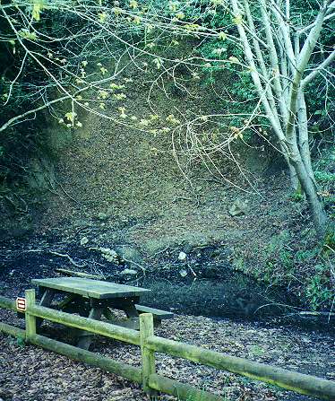
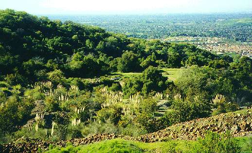
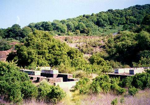
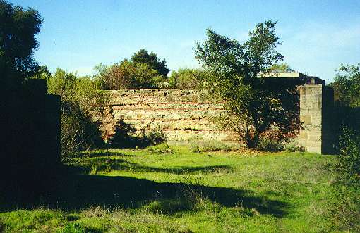
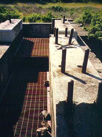
There are a number of old mining structures on the southeast upper slopes of the park. They can be reached by taking trails from the Mockingbird Hill entrance or the Hacienda entrance. A number of small side trails branch off from them. Starting from the high point of the park, Mine Hill, 3/10 of mile below Bull Run, a short branch leads off the Mine Hill Trail to the only mine entrance that has not been sealed shut. The San Cristobal Mine entrance is open for a short distance, then is blocked by a gate. The mine shaft is visible through the bars of the gate. Cool air can be felt coming out of the mine. Bats live in the mine and can sometimes be seen flying in and out of the tunnel. 0.4 miles farther down the Mine Hill Trail, the April Trail is a small loop trail that branches off and descends to the west. At a bend it passes by a small brick building, the powder house, that was used for storing mining explosives. The trail descends to the remnants of a huge structure on a trestle where ore cars on rails would dump their loads into a chute. The chute would channel the ore into dump trucks. The trucks would take the ore to the rotary furnace on Mine Hill for processing.. The April Trail climbs back up to rejoin the Mine Hill Trail. A short distance away, the narrow, shady footpath, the Great Eastern Trail, descends to meet the Day Tunnel Trail, another narrow footpath. Taking this to the left, it reaches the Randol Trail at the Day Tunnel. The Day Tunnel is a sealed mine opening in the side of a cliff. There is a tree-shaded rest area here with picnic tables. A small pond lies below the tunnel opening. Piles of mine tailings from the Day Tunnel can be seen below the Randol Trail. Taking the Randol Trail to the west, it passes by the Buena Vista Shaft site. The hills near the shaft have a desert-like appearance, covered with piles of red rock mine tailings and scattered stands of pampas grass. The massive granite footings of the huge Cornish pump for the Buena Vista Shaft can be seen. Steel safety grills prevent falling into the dip pits within the footings.. A narrow footpath, the Buena Vista Trail, leads down through stands of chaparral and cool forests to the New Almaden Trail. The New Almaden Trail can be taken east for 1.2 miles to the Mockingbird Hill entrance.
Click on the thumbnails below to see a larger picture:
 |
 |
 |
 |
|
|
|
|
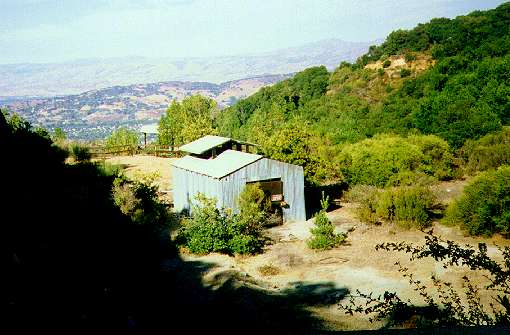
Old storage building |
 |
 |
 |
 |
|
|
|
|
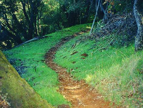
Great Eastern Trail to the Day Tunnel Trail |
 |
 |
 |
 |
|
|
|
|
Footings of Buena Vista Shaft pump |
 |
 |
 |
 |
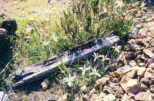
| Lilies by old timber and mine tailings | Granite footings of the Buena Vista shaft pump | Close-up of pump footing and safety grate | The Buena Vista Trail near the New Almaden Trail |
Created 3/5/2001, updated 5/23/2006 by Ronald Horii