Home
![]()
Northside
Trails
![]()
New
Almaden
Trail
![]()
Southeast
Trails
![]()
New
Almaden,
Museum
![]()
Southwest
Trails
![]()
Links
![]()
Bay Area Hiking
![]()
County
Parks![]()
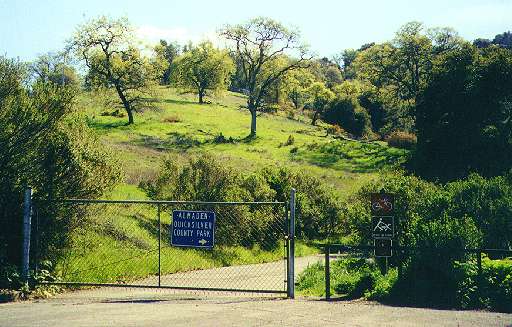
Almaden Quicksilver County Park
New Almaden Trail and the Eastside Trails
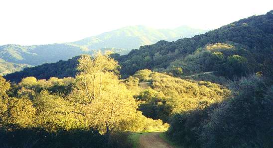
The New Almaden Trail
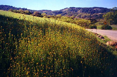
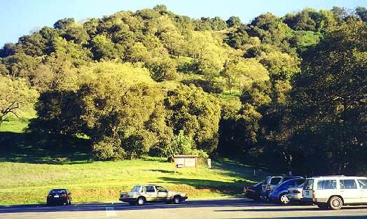
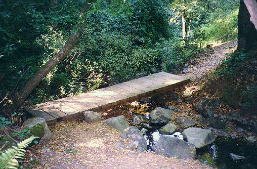
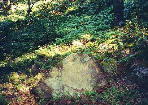
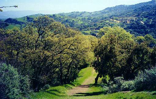
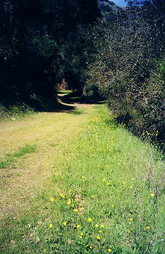
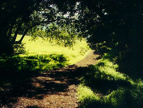
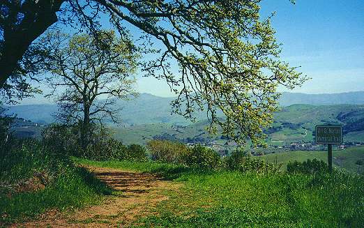
The eastside of Almaden Quicksilver Park is shaded from the afternoon sun by the Los Capitancillos Ridge. This part of the park has deep oak woodlands. Three trails run along the eastside: The New Almaden Trail, the Hacienda Trail, and the Virl O. Norton Memorial Trail. The New Almaden Trail is the longest trail in the park. It runs for 6.7 miles along the middle of the northeast slopes of the park to the Mockingbird Hill entrance of the park. The Mockingbird Hill entrance is located at the end of Mockingbird Hill Lane, which is off Almaden Road near the end of Almaden Expressway. The trail starts in shady woods near the parking lot. Along the way are interpretive signs installed as an scout project.Click on the thumbnails below to see a larger picture:
 |
 |
 |
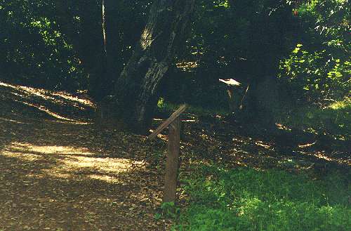 |
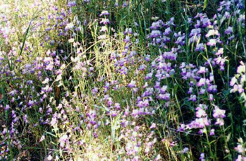
| Wildflowers near the Mockingbird Hill entrance | Mockingbird Hill entrance parking lot | Start of the New Almaden Trail | Interpretive signs along the New Almaden Trail |
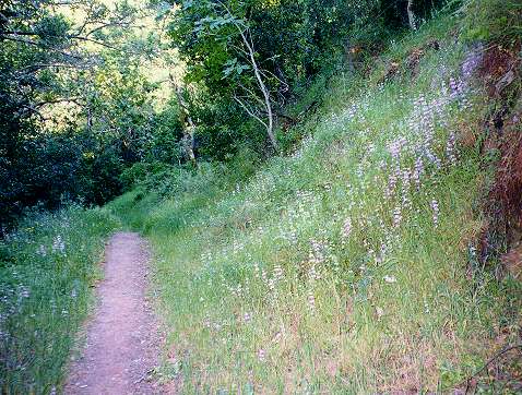
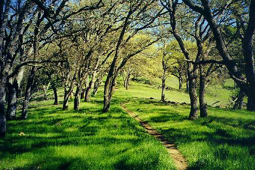
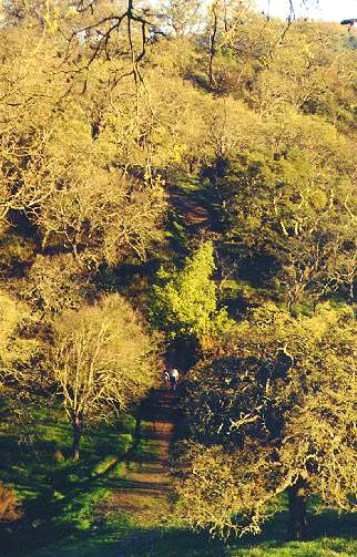
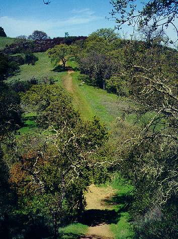
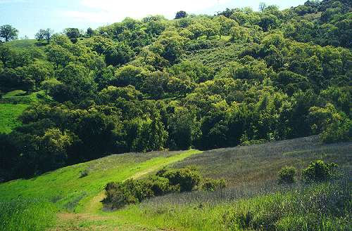
The New Almaden Trail is a narrow footpath (hiking only). It
is one
of the coolest and shadiest trails in the park. It is mostly level, but
makes lots of small ascents and descents. It winds in and out of narrow
ravines, crossing several small creeks along the way. In the
springtime,
shade-loving wildflowers line the green slopes along the trail. The
pictures
below are of parts of the trail near the Mockingbird Hill entrance.
 |
 |
 |
|
|
|
|
The middle part of the New Almaden Trail is accessible from
the Webb
Canyon entrance, hidden deep in a suburban neighborhood in the Almaden
Valley. The northern part of the trail is covered in the northside
trails page.
 |
| Webb Canyon entrance to the New Almaden Trail |
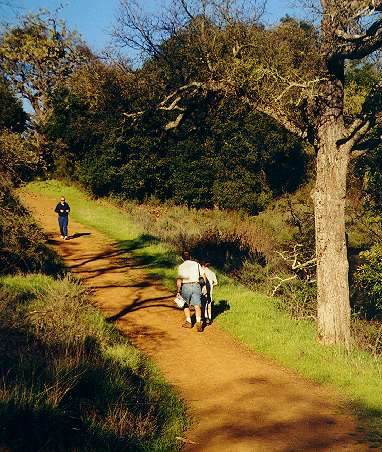
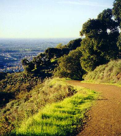
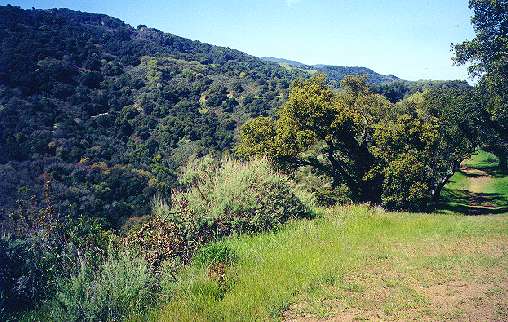
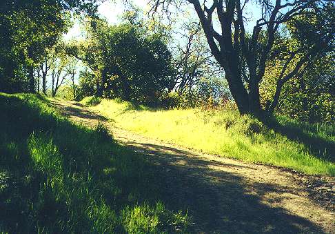
The New Almaden Trail is one of the least crowded trails in
the park.
It is only open to foot traffic. It is best for long, slow walks in the
woods, but people do run on it. The Quicksilver
Running Club holds races on the trail. Even though it runs closer
to
suburban neighborhoods than most of the trails in the park, these
neighborhoods
are usually not visible because of the dense vegetation. The trail
ahead
is usually only visible for a short distance ahead, so pleasant
surprises
can be around each bend. In some cooler, shadier places, ferns cover
the
hillside. The trail is long, but it can be broken up into shorter loop
trips by taking short connector trails to the upper trails. The Buena
Vista
and Prospect #3 connect to the Randol Trail. The Cinnabar Trail, which
is shown on the Northside Trails page,
connects
to the Mine Hill Trail.
 |
 |
 |
 |
| Flowers lining the trail near the Webb Canyon Entrance | Trail climbs a hill through a forest south of the Web Canyon entrance | Poppy-covered hill below the trail near the Cinnabar Trail junction | Fern-covered hill near a small creek in a shady ravine |
The Hacienda Trail
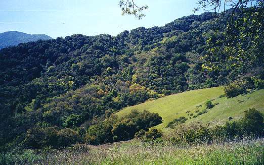
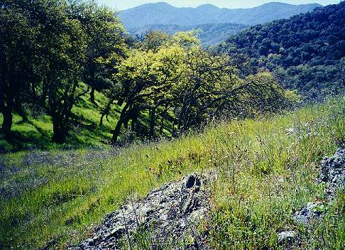
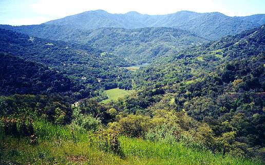
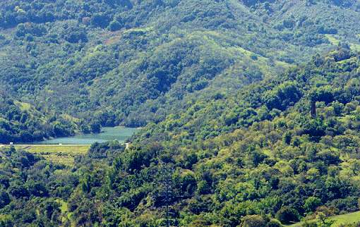
The Mockingbird Hill entrance is also the start of two of the park's other eastside trails: The Hacienda Trail and the Virl O. Norton Memorial Trail. The Hacienda Trail begins next to the New Almaden Trail in a shady forest, then rises quickly. It is the steepest trail in the park. Taking it uphill provides a good workout. It climbs straight up through oak-shaded forests, with increasingly dramatic views of the park, the Almaden Valley, and the Santa Teresa Hills. Even after it seems to reach its peak, the trail drops and rises over the ridgeline of one narrow hill after another, like a roller coaster. After 1.2 miles, a short connector trail, the Capehorn Pass Trail, heads south and connects the Hacienda Trail with the junction of the Mine Hill Trail and the Randol Trail. From the Capehorn Pass junction, the Hacienda Trail turns east, and in half a mile, meets the southern end of the Virl O. Norton Memorial Trail. The Hacienda Trail then turns southeast and runs up and down more hills, paralleling the Mine Hill Trail. From here there are great views of the Mine Hill Trail dropping down towards New Almaden. In the distance, Almaden Reservoir and dam lies below the wooded slopes of Mt. Loma Prieta, the highest point in the Sierra Azuls. The New Almaden chimney can be seen rising above the trees on a hill above New Almaden. The trails turns to the southwest and begins a steep descent along chaparral-covered slopes that are covered with orange sticky monkey flowers in the spring. It then runs down through a cool canyon. Finally, it ascends to join the Mine Hill Trail near the English Camp Trail junction at 0.4 miles from the Hacienda entrance of the park and 1.5 miles from the Norton Trail junction. The Mine Hill Trail can be taken to Capehorn Pass, which leads back to the Hacienda Trail.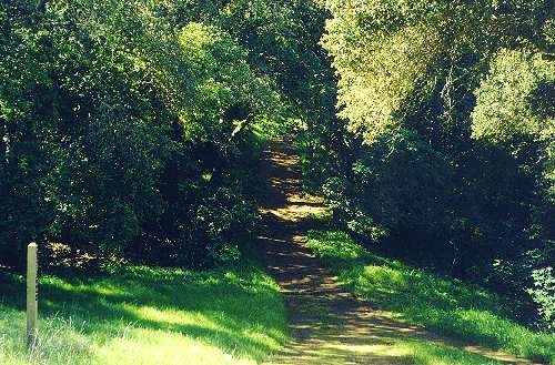 |
 |
 |
 |
| Hacienda Trail start at the Mockingbird Hill entrance | Hacienda Trail climbing uphill near the Mockingbird Hill entrance | Looking northwest along the Hacienda Trail | Capehorn Pass Trail heading south towards the Mine Hill and Randol Trails |
 |
 |
 |
 |
| Hacienda Trail heading uphill hill south of the Norton Trail | Mine Hill Trail seen from the Hacienda Trail | Rocks and grove of trees along Hacienda Trail | Looking back north towards the Norton Trail |
 |
 |
 |
 |
| Looking back towards the Mine Hill Trail below Mine Hill | View of Mt. Loma Prieta, Almaden Reservoir, start of the Mine Hill Trail | Zoom-in view of Almaden Reservoir and the New Almaden Chimney | Hacienda Trail descending towards New Almaden |
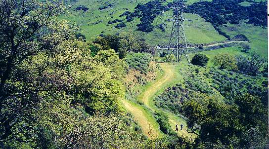 |
 |
 |
 |
| Looking down from Hacienda Trail at power tower service spur road | Hacienda winds down a canyon before ascending to the Mine Hill Trail | Looking back down the Hacienda Trail just below the Mine Hill Trail | Hacienda Trailhead at the Mine Hill Trail. Hacienda Trail climbs up the hill in the background |
The Virl O. Norton Memorial Trail
From the Hacienda Trail, the 1.2-mile Virl O. Norton Memorial Trail, named in memory of famous local horseman Virl Norton, drops down steeply, then runs along the edge of the park near large homes and ranches, eventually ending at the Mockingbird Hill entrance. Going in the reverse direction up the Norton Trail from the Mockingbird Hill entrance, the relatively flat section of the trail seems easy compared to the steep Hacienda Trail, even going downhill in portions. However, the Norton Trail has to climb to reach the Hacienda Trail, so it makes a tough climb near the end. It provides spectacular views of the Almaden Valley and the Santa Teresa Hills. The trail was closed for awhile for re-alignment and was re-opened in 2004 as part of the Bay Area Ridge Trail. It is now open to bicycles, hikers, and equestrians.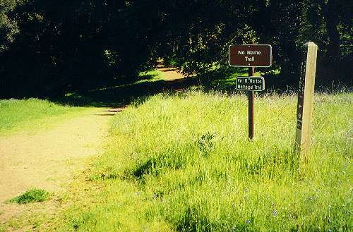 |
 |
 |
 |
| Norton Trail entrance from the Mockingbird Hill parking lot | Looking back along the Norton Trail towards the Mockingbird Hill entrance | Norton Trail running along the hillside by homes | First big drop along the trail |
 |
 |
 |
 |
| Ranches next to the trail before the long ascent | Trail ascends steeply, then turns | Looking back down the trail at the first drop and the houses next to the trail | Norton Trail entrance at the Hacienda Trail |
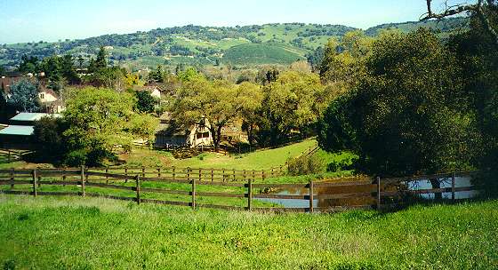
Mockingbird Hill Lane leads to Almaden Road near McKean Road, which in turn leads to Harry Road. Harry Road can be taken to reach the Alamitos Creek Trail and the Calero Creek Trail. The Alamitos Creek Trail leads to San Jose's Almaden Lake Park (not to be confused with Almaden Reservoir near New Almaden). The Calero Creek Trail leads to Santa Teresa County Park.
Created 3/5/2001, updated 7/2/2009, by Ronald Horii