
Quicksilver Mining
Museum
NAQCPA Home
New Almaden Day 2007
New Almaden Day 2008
Pioneer Day 2007
Pioneer Day 2008
Pioneer Day 2009
New Almaden Day 2010
Pioneer Day 2010, Casa Grande Reopening
Pioneer Day 2011
Almaden Quicksilver Park Links
AQS Park Home
![]()
Northside
Trails
![]()
New
Almaden
Trail
![]()
Southeast
Trails
![]()
New
Almaden,
Museum
Southwest
Trails
![]()
Links
![]()
Bay Area Hiking
![]()
County
Parks
NAQCPA Home![]()
I took these pictures on 1/27/12.
I started at the Mockingbird Hill Lane staging area of Almaden
Quicksilver
County Park. I hiked up the Hacienda Trail to the New Almaden Trail,
went up the Buena Vista Trail to the Buena Vista Shaft site. I then
followed the Randol Trail to the Day Tunnel. I continued on the Randol
Trail to Capehorn Pass, then returned on the Hacienda Trail.
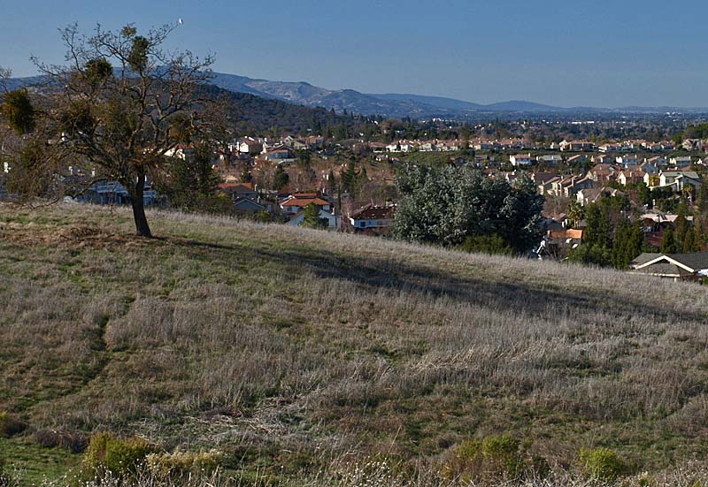
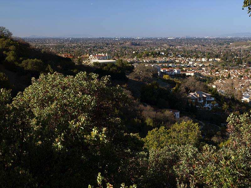
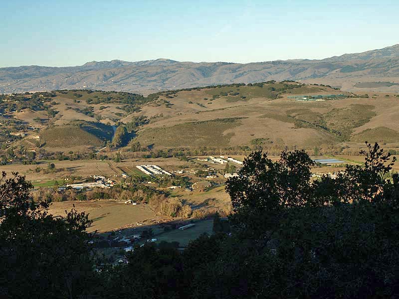
This is a view from the parking
lot of the staging area looking up the
Almaden Valley, showing what a clear day it was. In the background are
the Santa Cruz Mountains along
the Peninsula. The bare hills are the rock quarry west of Stevens Creek
County Park.The residential neighborhoods of the Almaden Valley come
right up to the eastern borders of the park. The Mockingbird Hill Lane
Staging Area is the main entrance to the park from its most populated
side. It has a large parking lot, restroom, drinking water, and picnic
tables. The parking lot is gated, so is only open until sunset.
Mockingbird Hill Lane leads to McKean Road and Harry Road and is a
connector to the Calero
Creek/Los Alamitos Creek Trails, which are part of the Bay Area Ridge Trail.
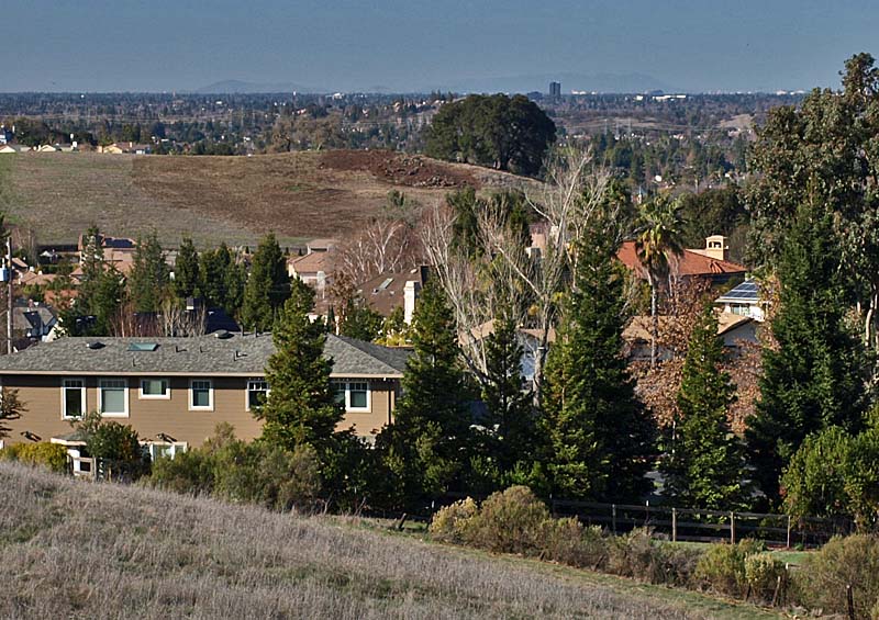
This is another view from the parking lot at the Mockingbird Hill Lane Staging Area showing the visibility of over 60 miles. On the horizon are Mt. San Bruno, the Pruneyard Towers, the hangars at Moffett Field, and Mt. Tamalpais.

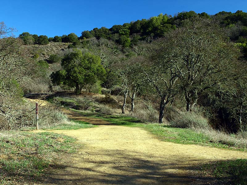
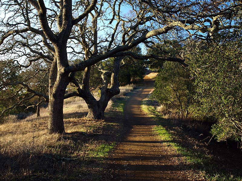
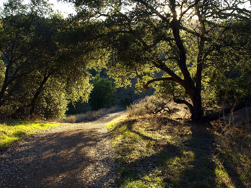
The start of the Hacienda Trail runs through a shady forest.
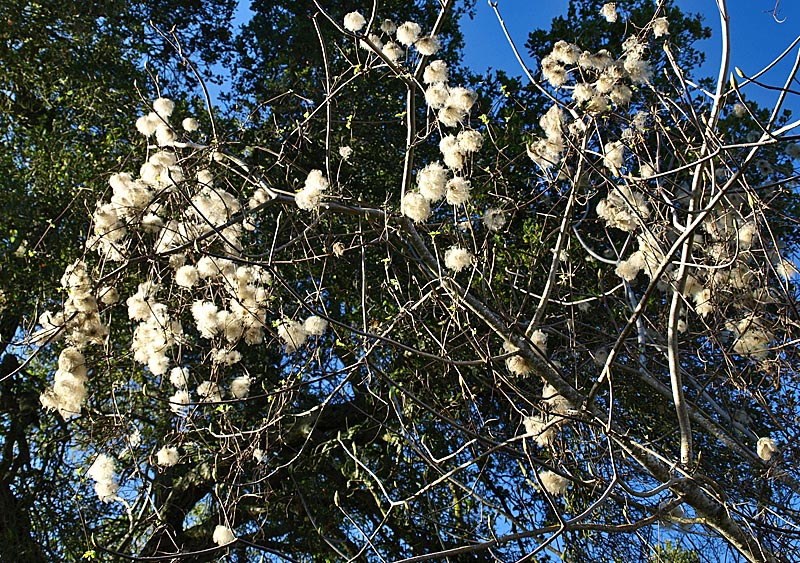
Clematis seed puffs.
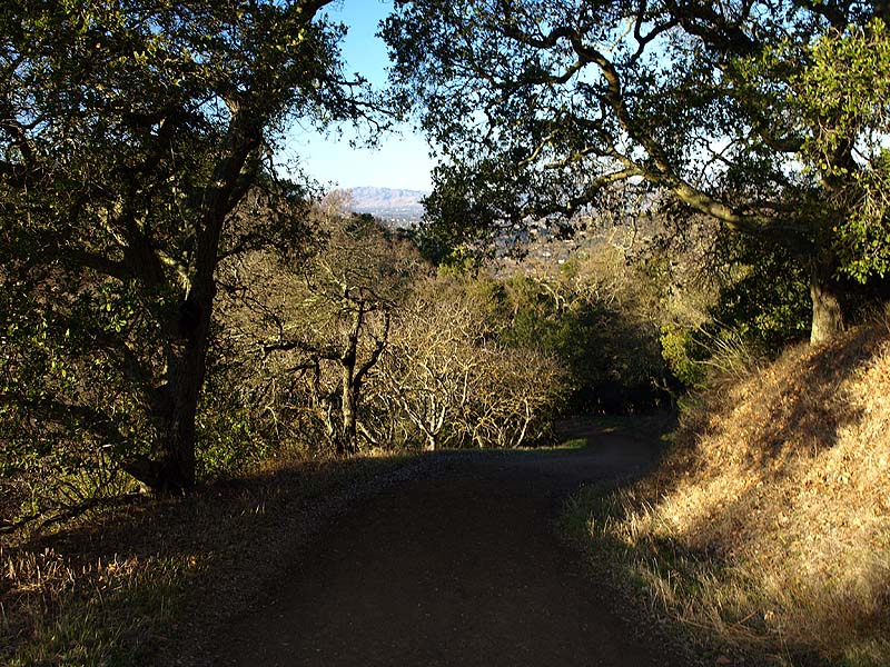
Ahead is the junction of the Hacienda and New Almaden Trails. I started on the New Almaden Trail on the right and returned on the Hacienda Trail (center).
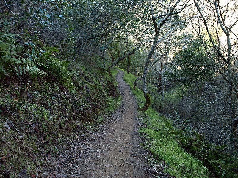
The New Almaden Trail is a very shady trail. Ferns, grasses, and broadleaf plants line the trail.
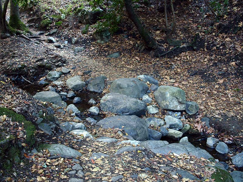
Despite the recent rain, this was the only creek flowing on the route. The creek crossing is on the flat boulders ahead. The creek flows around the boulders.
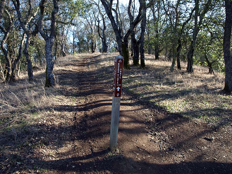
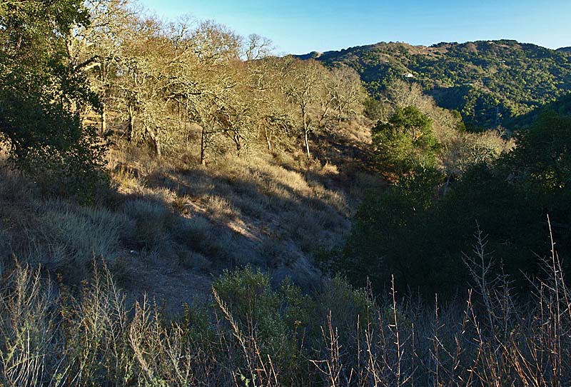
This is the start of the Buena Vista Trail, which goes uphill from the New Almaden Trail for 0.3 miles and joins the Randol Trail just below the Buena Vista Shaft site.
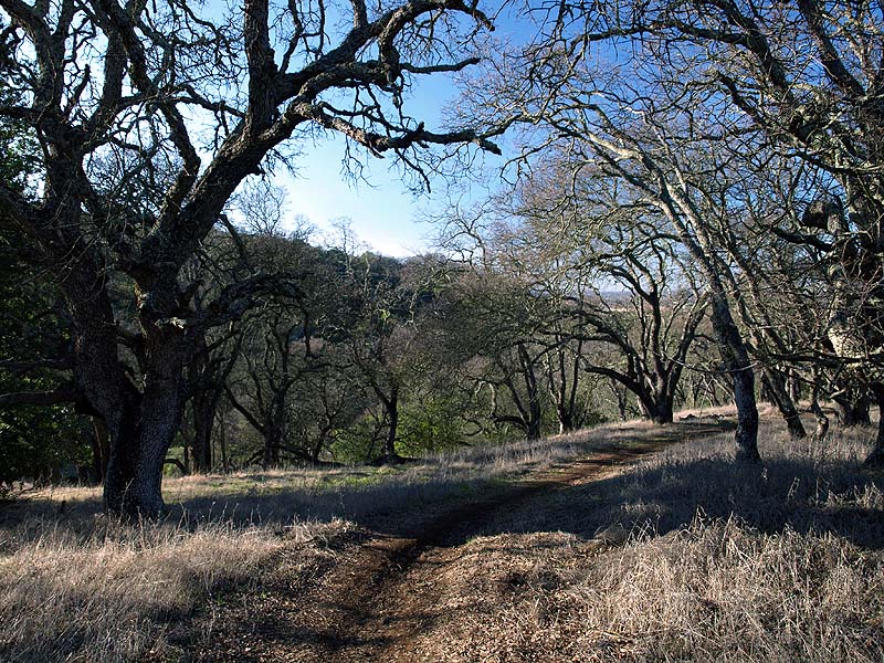
This is a view looking down the Buena Vista Trail. On the lower part, it runs through this open oak forest.
As the Buena Vista Trail ascends the hill, it rises above the forests, revealing views of the Almaden Valley and the South Bay.
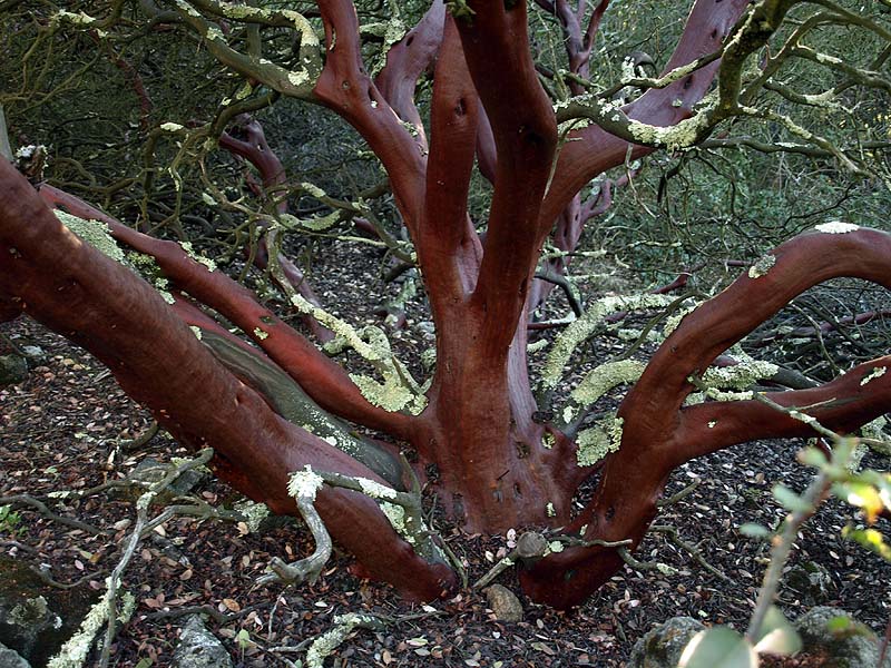
The Buena Vista Trail runs through a forest of manzanita, scrub oak, and coyote brush. Here is a manzanita, covered with lichens.
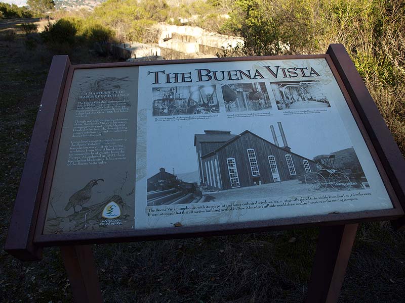
The Buena Vista Trail leads to the
site of the Buena Vista Shaft. There
is an interpretive sign here that talks about the site and the huge
pumps that were here. The gigantic Cornish pumps were used to pump
water out of the mine shafts, which were hundreds of feet below sea
level. This is what it says: "A MASTERPIECE OF MASONRY & MECHANICS.
The Buena Vista shaft commenced on July 5, 1882. It became the deepest
sunk into the Quicksilver Mining Company's lands, eventually reaching a
depth of 2,300 feet, 600 feet below sea level. Though not itself a
significant source of ore, the Buena Vista's value was in pumping water
out of neighboring flooded mine tunnels, thus allowing miners to follow
veins of cinnabar ore deeper into the earth. Considered a masterpiece
of masonry, the Buena Vista's pumphouse foundation was constructed
using sandstone from New Almaden and immense blocks of granite from the
Sierras. Abandoned in 1893, these foundation blocks are all that remain
of the Buena Vista today." The picture on the upper left says, "The
Cornish pump's flywheel measured 24 feet in diameter and weighed 25
tons. In 1887 the pump raised 86,000,000 gallons of water." The top
center picture says, "Six coal-fed boilers in a brick-lined room
supplied steam power for pumps, hoist, and air compressor engines." The
top right picture says, "A dual-hoist system raised and lowered cages
carrying miners and ore cars into the descending shaft." The large
picture at the bottom says, "The Buena Vista pumphouse with its red
paint and fancy cathedral windows was strategically placed to be
visible from San Jose, 12 miles away. It was intended that this
attractive building nestled in New Almaden's hillside would draw
wealthy investors to the mining company."
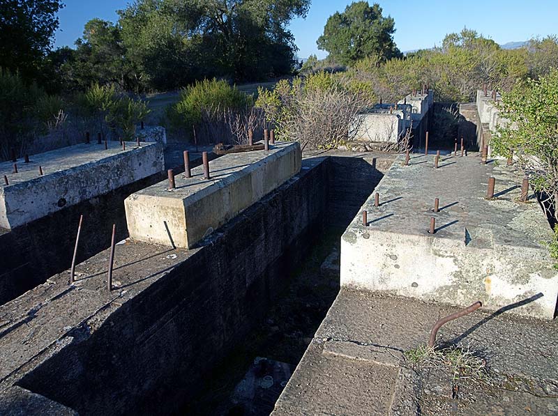
All around are granite foundations that supported the heavy pump equipment, sitting on top of sandstone walls.
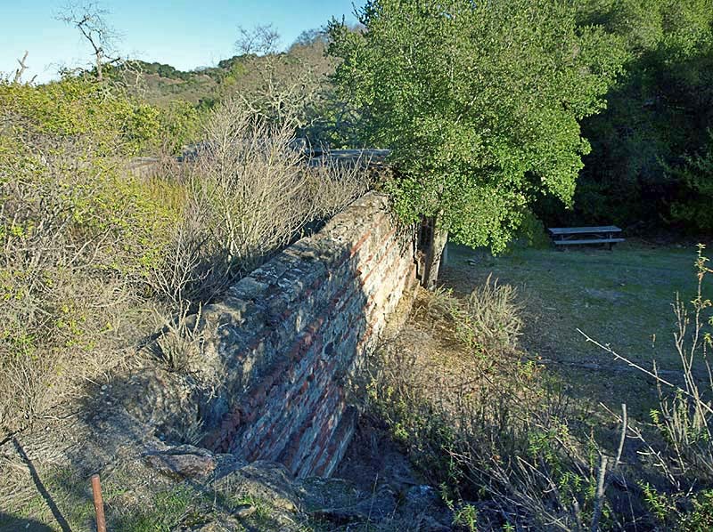
There is an old brick wall here.
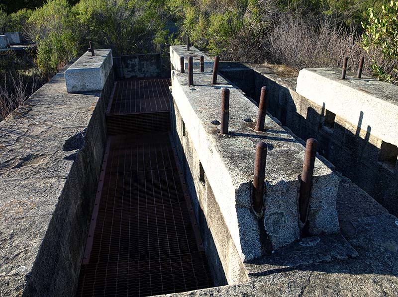
The metal grates cover pits that are several stories deep. They provided clearance for the pump's 24-foot diameter flywheel.
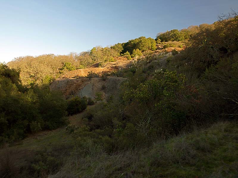
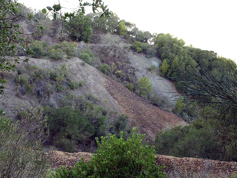
On the other side of the valley are piles of waste rock from the mine.
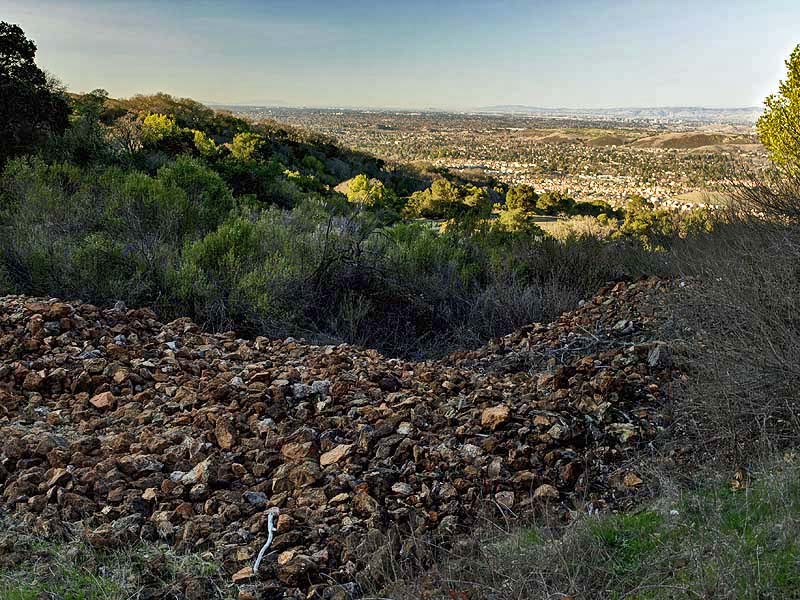
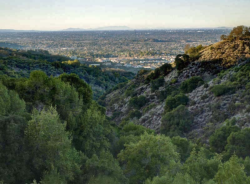
This is a view from the Randol Trail. On the left is downtown San Jose. To the right on the horizon is Mission Peak. In the center is the Almaden Valley, with the Santa Teresa Hills behind it.
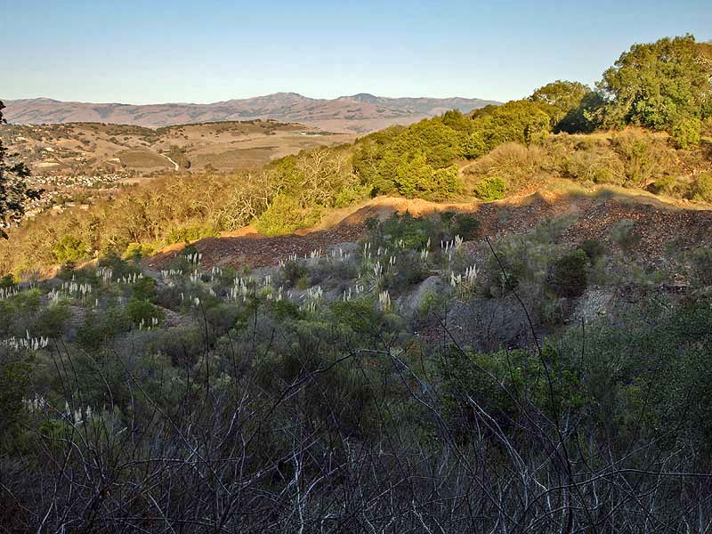
The Randol Trail runs around the huge piles of waste rock. The white tufts are from non-native pampas grass.
This is a view from behind the rock pile, with the Buena Vista Shaft foundations across the valley in the center.
This is another view looking across the rock pile towards the Buena Vista Shaft foundations left of center.
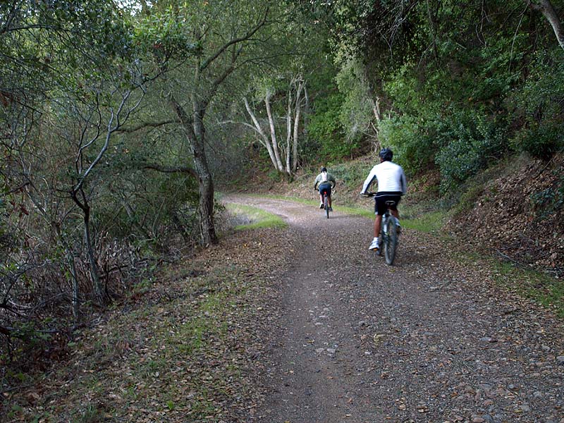
The Randol Trail is an old mine road, so is wide and well-graded, with a hard surface. It is one of the trails in the park that is open to bicycles.
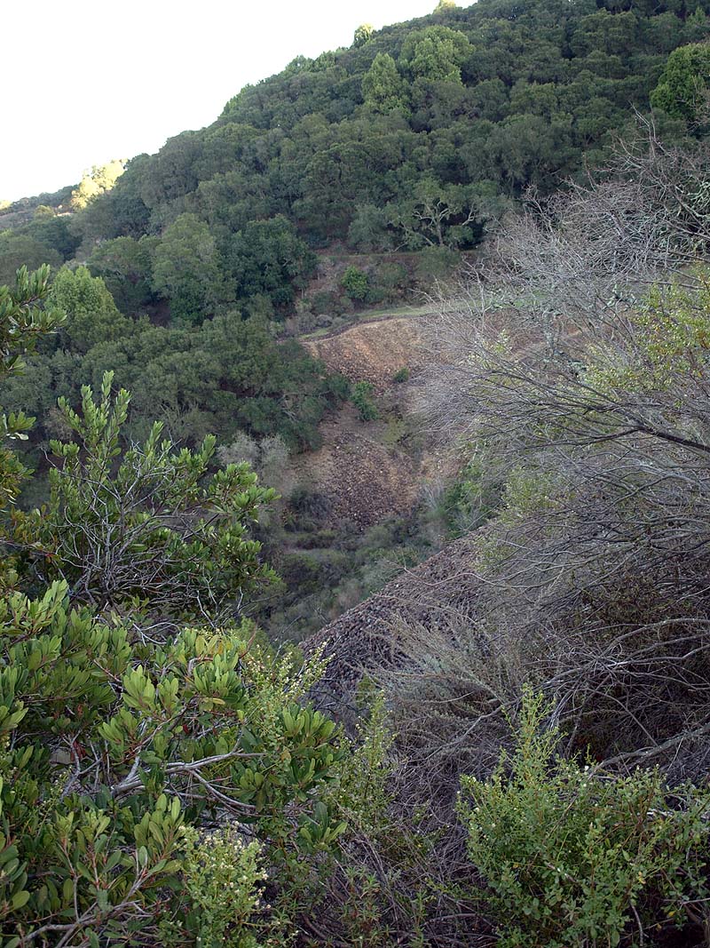
This is a view looking across a canyon at the rock pile below the Day Tunnel.
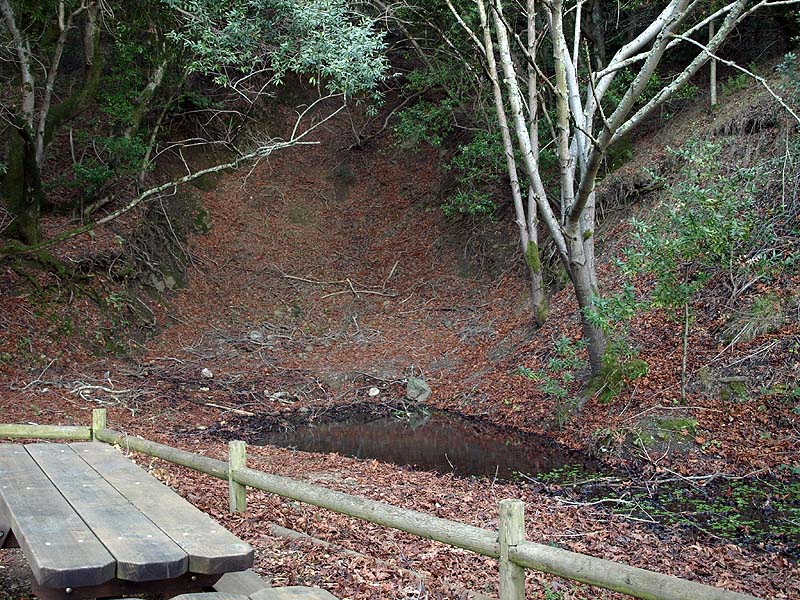
This is the location of the Day Tunnel. The tunnel entrance has been sealed. A small pond is below it, which is full of newts.
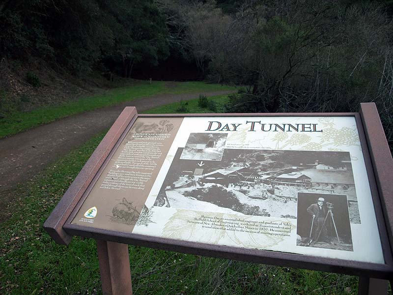
This is the interpretive sign for
the Day Tunnel, which is in the
background. The sign says, "A SIGNIFICANT ADDITION TO NEW ALMADEN'S
RICH MINING OPERATION. Toxic gases and underground water posed perils
and problems for miners in search of valuable cinnabar ore. Under
Sherman Day's suggestion, the "New Tunnel" was dug at the 800 foot
level to help ventilate and drain the vast catacombs of underground
tunnels and shafts. Later re-named the "Day Tunnel", this new passage
into some of the mountain's hardest rock proved to be quite profitable.
For much of the 1870's miners hauled nearly all of the company's
cinnabar out through this one opening. It was also Sherman Day who
suggested building a new road (now known as the Randol Trail) for
easier access to the mine and tunnel. Although the Day Tunnel entrance
and planilla are not visible today, evidence of the tons of rock that
passed through them can be seen along and below the trail." The upper
picture captions say, "left: Tunnel etrance 1860. below: Day Tunnel
Planilla (ore sorting shed) ca late 1800s." The caption at the bottom
says, "Sherman Day, an accomplished engineer and graduate of Yale's
Sheffield School of Engineering, was hired as Superintendent and
Surveyor of New Almaden's Quicksilver Mines in 1857. He conceived
several ideas that added to the success of the mining operations."
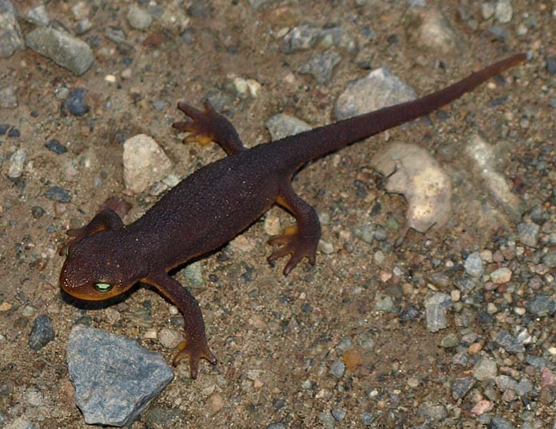
This errant California newt is crawling on the Randol Trail.
This is a view looking back at the rock pile below the Day Tunnel, with the Randol Trail above it.
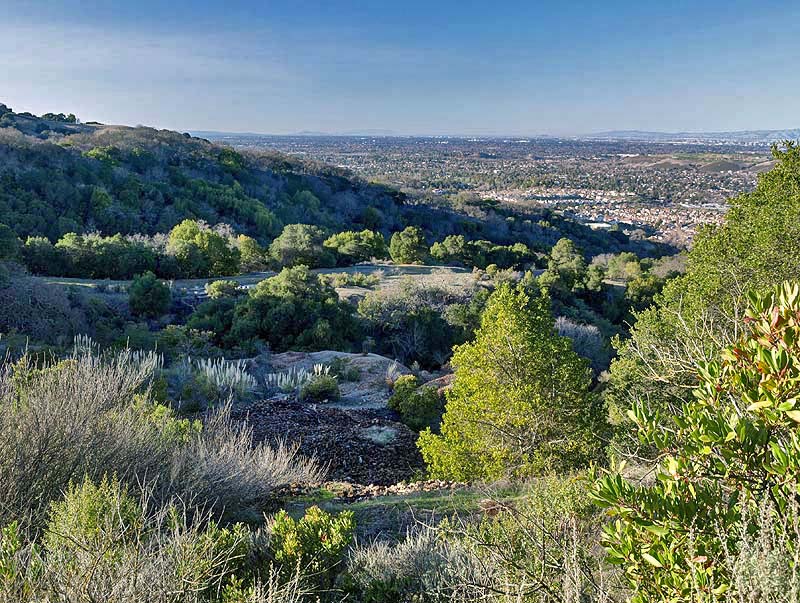
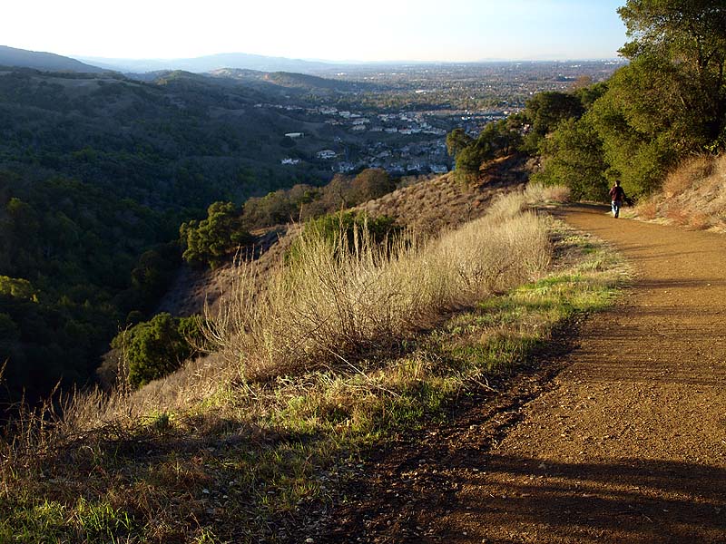
As the Randol Trail approaches the Mine Hill Trail, it turns towards the east, and the trees clear away, providing views north up the Bay. Here on the horizon are Mt. San Bruno and Mt. Tamalpais. On the right is the hill that the Hacienda Trail climbs and runs along the ridgeline.
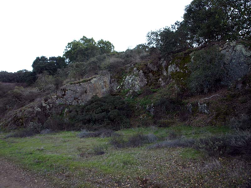
This part of the hill is cut, revealing the rocks at the heart of it.

The Randol Trail ends at the junction of the Mine Hill Trail and the Capehorn Pass Trail. This is the Mine Hill Trail heading downhill. It is open to bicycles, as is the Capehorn Pass Trail.
This is a view from the trail junction, looking towards the south end of the Hacienda Trail on the lower left. The hill in the background is covered with private estates.
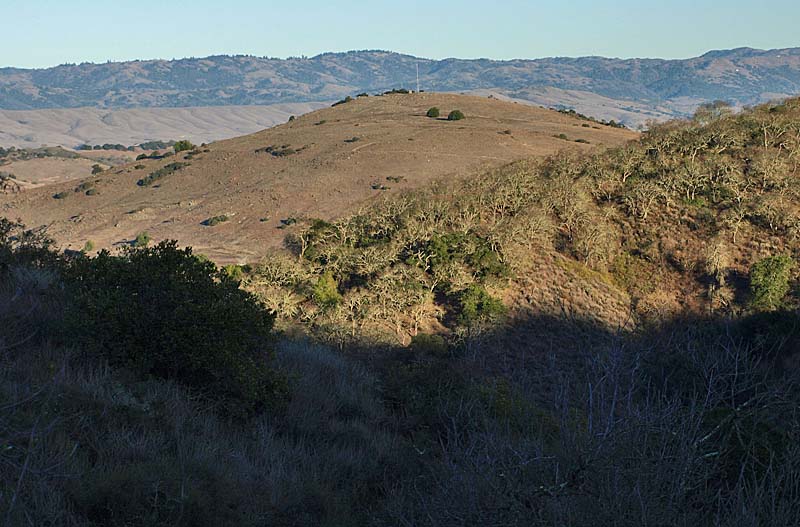
Also seen from the trail junction
is this antenna-topped hill in the center. It is
part of Rancho San Vicente, the newest addition to Calero County Park,
but not yet open to the public. Plans are in the works to open up
trails to the public and eventually connect the park to Almaden
Quicksilver. Guided tours of Rancho San Vicente are offered by the
County Parks and the Peninsula Open Space Trust.
This is a view from the Capehorn
Pass Trail, which is a short connector
trail that leads to the Hacienda Trail. At the trail junction, you can
take the Hacienda Trail to the right, which runs along the ridgetop
seen in the picture above, leads to the Virl O. Norton Trail, and ends
near the junction of the Mine Hill Trail and English Camp Trail.
Alternatively, the Hacienda Trail can be taken back to the Mockingbird
Hill Staging Area, which is what I did. The Mine Hill, Capehorn Pass,
and Virl O. Norton Trails are part of the Bay Area Ridge Trail network.
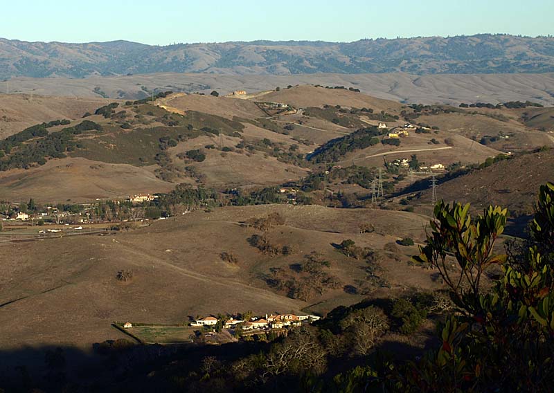
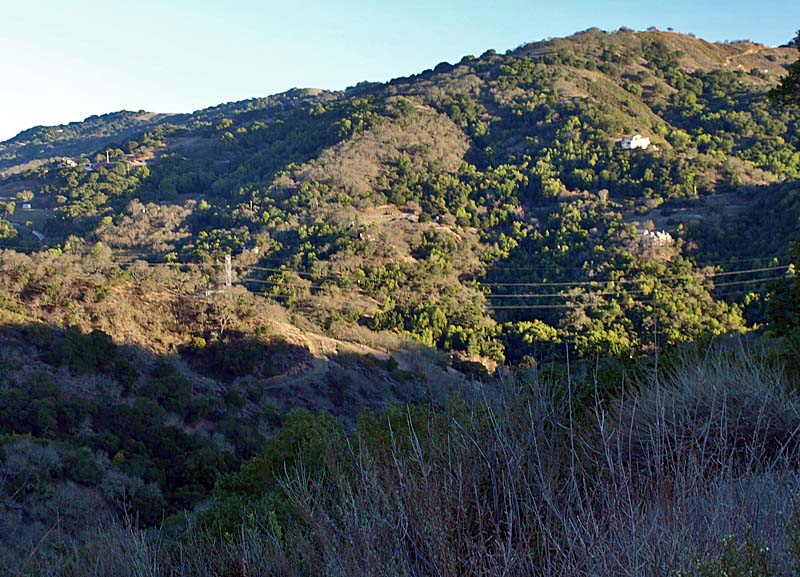
This is a view from the Hacienda Trail. The undeveloped hills below are part of Rancho San Vicente. The developed hills background are part of a private residential development. The main road is County View Drive.
This is another view from the Hacienda Trail looking more to the left. The cattle are grazing on the north end of Rancho San Vicente. The road in the center is McKean Road. The hills in the center are part of Santa Teresa Park.
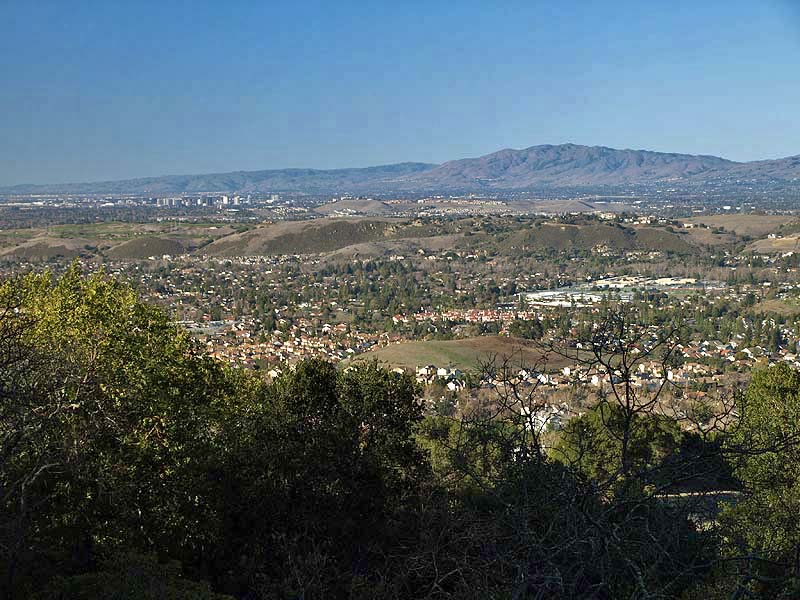
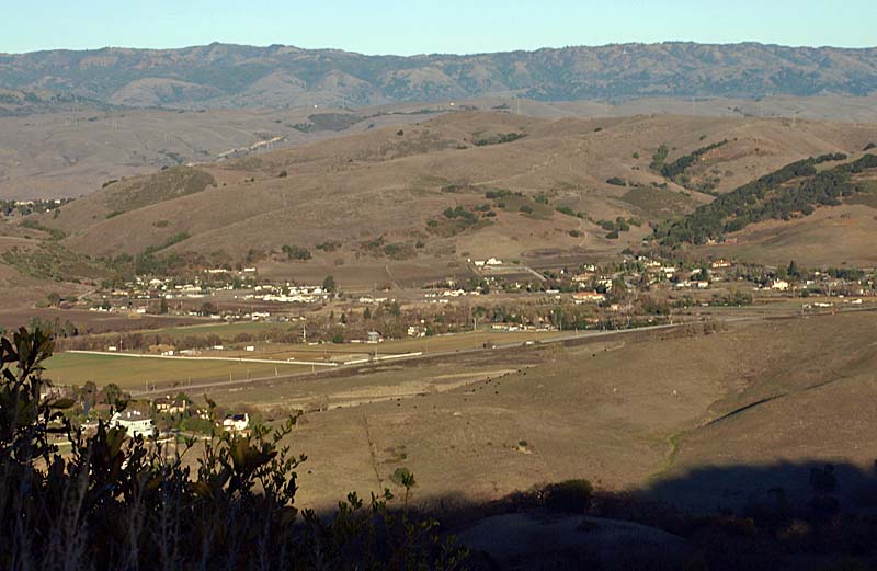
Farther along the Hacienda Trail, the hills in the center are the Santa Teresa Hills. The green buildings on top of those hills comprise IBM's Almaden Research Center. The hill behind it is Bernal Hill. Santa Teresa Park is behind it. The hills to the left are private.
The Hacienda Trail is very steep. It is the steepest trail in Almaden Quicksilver. This is a view looking down the trail. The New Almaden Trail runs along the lower part of the hills on the left.
This is another part of the Hacienda Trail dropping steeply down the hill through a forest of scattered oak trees.
The Hacienda Trail makes a short steep climb to a viewpoint.
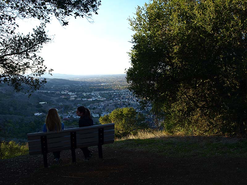
This is the viewpoint, which has a bench.

From the viewpoint, you can see the hills of Almaden Quicksilver on the left. The New Almaden Trail runs along the lower part of these hills.
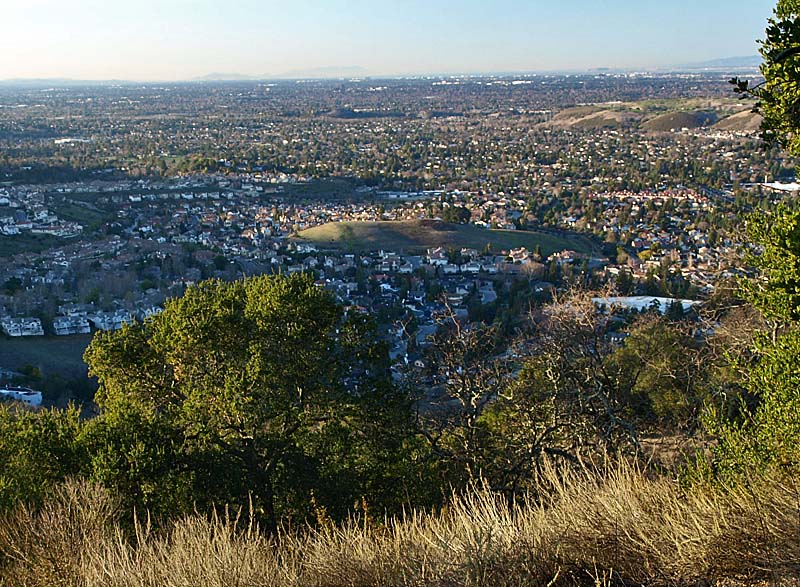
This is another view from the viewpoint, looking down the Almaden Valley, with downtown San Jose on the upper right.
The Hacienda Trail makes another steep drop downhill. In the background is downtown San Jose.
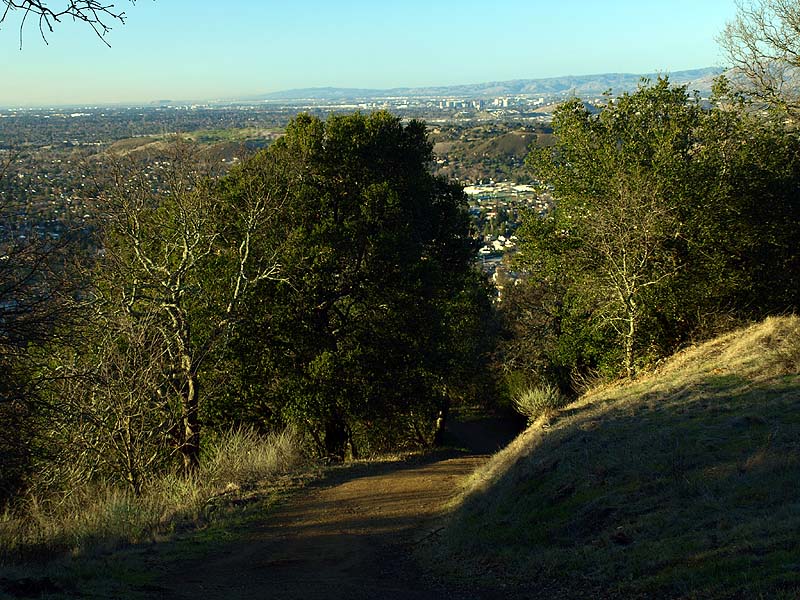
The Hacienda Trail turns and heads west for a short distance.
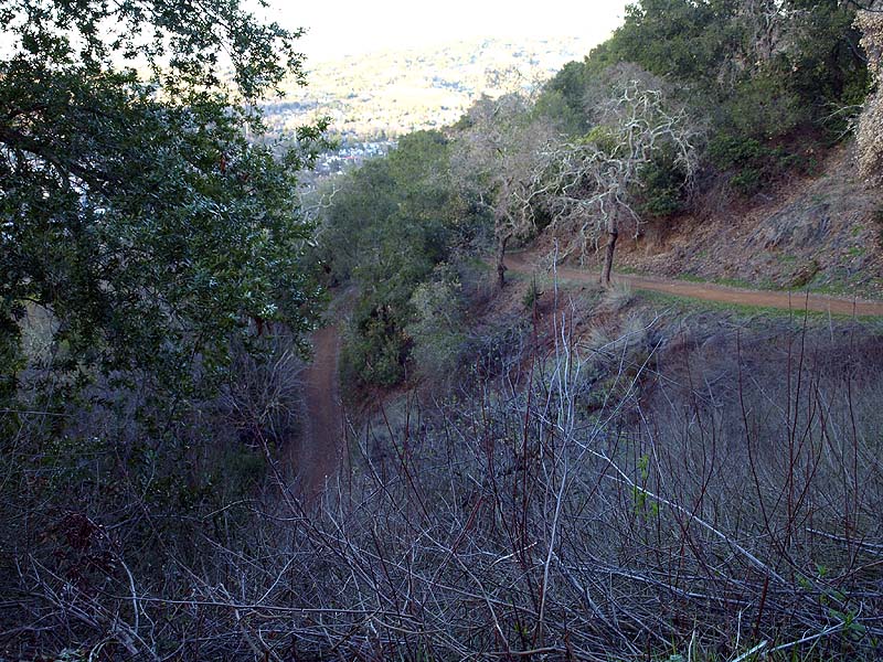
Ahead, the Hacienda loops around and makes a very steep drop.
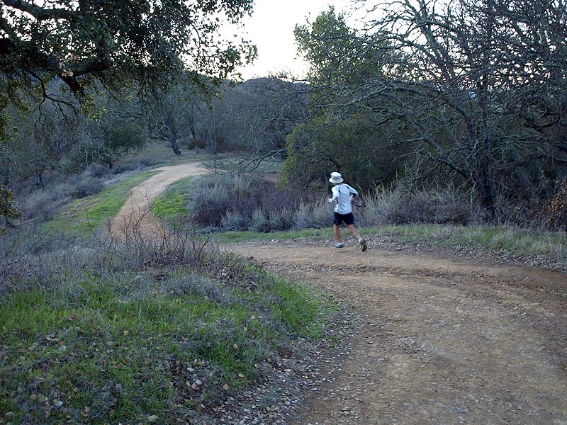
Finally, the Hacienda Trail joins the New Almaden Trail. Both drop down to the Mockingbird Staging Area, but the New Almaden Trail is more gradual.
For pictures from an earlier hike on the New Almaden Trail to the Buena Vista Shaft, see this Facebook Album.
Created 1/28/12 by Ronald Horii